Water Trails
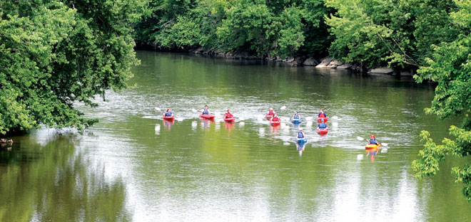
The Great Miami River Watershed Water Trail system offers 265 miles of waterway accessible to recreational boaters, fishermen and wildlife watchers.
About Water Trails
![]() The Dayton area has an incredible resource with its network of rivers and streams. Five Rivers MetroParks is actively working to create better access to water – to fulfill our vision of an integrated system of recreation and water trails that can be used in a variety of ways to improve the quality of life in the Dayton region.
The Dayton area has an incredible resource with its network of rivers and streams. Five Rivers MetroParks is actively working to create better access to water – to fulfill our vision of an integrated system of recreation and water trails that can be used in a variety of ways to improve the quality of life in the Dayton region.
A water trail is an official state designation given to a river or creek primarily used for recreational canoeing and kayaking. For a stretch of water to garner official state designation as a water trail it needs to include a public planning process, maps and signage, access points, management/stewardship commitment, safety information, local government partnership and a logo.
In 2010, the Great Miami, Stillwater and Mad Rivers became part of the designated Great Miami River Watershed Water Trail – the largest water trail system in Ohio. The trail collectively offers 265 miles of waterway accessible to recreational boaters, fishermen and wildlife watchers. In 2016, the Great Miami Watershed Water Trail was also named a National Water Trail System by the Secretary of the Interior — one of only 22 national water trail systems.
Five Rivers MetroParks is committed to a Blueway/Greenway system that envisions safe access for paddlers and a connected network of services to support the recreational trails and river trails here in Dayton.
Our water trails are managed by the Miami Conservancy District in the Miami Valley.
Great Miami River Water Trail
Overview
The Great Miami River is perfect for paddlers and offers miles of beautiful streamside forests. It was designated as a state water trail in 2010. It flows through Taylorsville, Island, Deed’s Point, RiverScape and Sunrise MetroParks as well as a few protected conservation areas. New whitewater features are under construction on the river in downtown Dayton called RiverScape River Run.
Path
Originating just upstream from Indian Lake, the Great Miami River flows 156 miles southwest to its confluence with the Ohio River west of Cincinnati.
Camping
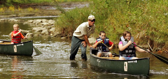
Trailside camping opportunities are available to paddlers at Island and Taylorsville MetroParks. A trailside camping permit is required for all overnight use of the campsites. Permits for all overnight use can be obtained online or by calling 937-275-PARK (7275).
- Each location is large enough for two small tents.
- These are primitive campsites that can support up to four to six persons per site depending on the style of the tent.
- Each location is within 1000 feet of a restroom.
- Maximum stay per camp (Eastwood A, Island A, and Taylorsville A) is two nights.
Mad River Water Trail
Overview
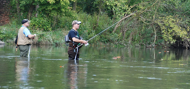
The Mad River is well known as a popular trout fishing and canoe and kayak destination. It was designated as a state water trail in 2010. It flows through Huffman, Eastwood and Deeds Point MetroPark before converging with the Great Miami River just east of RiverScape.
Path
The Mad River flows southwest for 65 miles from Logan County to the Great Miami River in downtown Dayton at Deed’s Point MetroPark.
Camping
Trailside camping opportunities are available to paddlers at Eastwood MetroPark. A trailside camping permit is required for all overnight use of the campsites. Permits for all overnight use can be obtained online or by calling 937-275-PARK (7275).
- Each location is large enough for two small tents.
- These are primitive campsites that can support up to four to six persons per site depending on the style of the tent.
- Each location is within 1000 feet of a restroom.
- Maximum stay per camp (Eastwood A, Island A, and Taylorsville A) is two nights.
Stillwater River Water Trail
Overview
The scenic beauty of the Stillwater River attracts paddlers and fishermen from all over the country. The river was designated as a state water trail in 2010. It flows through Englewood, Aullwood Garden, Wegerzyn Gardens, and Island MetroParks as well as a few protected conservation areas.
Path
The Stillwater Rivers begins near Greenville in Darke County and flows southeast for 45 miles where it joins the Great Miami River at Island MetroPark.