History of Five Rivers MetroParks
History of the Parks
Our parks have a rich history, and many were important to Dayton residents years before they became MetroParks.
From the first hiking trail at Dry Lick Run (now known as Carriage Hill MetroPark) to the recently constructed Tree Tower at Cox Arboretum MetroPark, we’ve compiled information to offer you a snapshot of each MetroParks’ unique history.
2nd Street Market
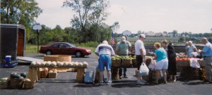
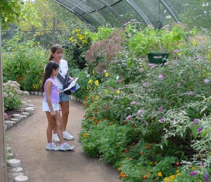
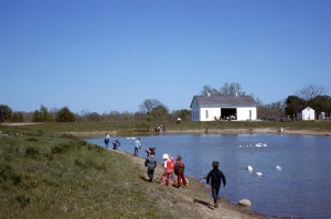
When Five Rivers MetroParks took over the maintenance and operations of the Wegerzyn Horticultural Center in 1995, they also inherited a thriving farmers market held weekly in the park, as well as several satellite locations such as Courthouse Square and the Dayton Mall. The farmers market had been established as a fundraiser for the Wegerzyn Foundation.
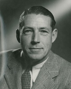
In 1998, Marvin Olinsky, the district’s director, envisioned expanding this market and moving it to downtown Dayton to Van Cleve Park (what is now RiverScape MetroPark) which was also newly administered by the agency as part of a bold new riverfront development plan. However, Olinksy also wanted to see that the market could be held year-round, which would require a covered structure. Building a market structure at Van Cleve turned out to be unfeasible at the time, so the district began to explore other locations downtown for the expanded year-round market.

Wegerzyn Farmers Market in the 1990s
Along came three developers working on a housing project in the Webster Station district of downtown called the Cannery. The Webster Station Development Group had a 45,000 sq ft warehouse garage as part of their complex that they were willing to utilize as a temporary home while their apartments were under construction. The Winter Market debuted in November 1998 and featured 18 vendors from Wegerzyn’s Farmer’s Market with foods like baked goods, organic vegetables and chicken & ostrich meat, kitchen and cooking-related items, soaps sold by the slice and gladioli, a favorite among the regular Wegerzyn crowd.
Developers saw the Winter Market as an opportunity to jump-start the effort of bringing a permanent downtown public market and draw attention to their housing project. The Winter Market proved to be so successful that the summer portion of the Wegerzyn Market was moved to the Cannery in May 1999 and dubbed it the Wegerzyn River Market. Freed of the space constraints of the Siebenthaler Avenue Wegerzyn Center, there was more vendors, 45, compared with as few as 15 who usually were on hand for the spring openings in the past. A new full-time market manager was hired by MetroParks to run this new venture. By June of that year, restaurants started to make an appearance at the market.
Dayton Mall Farmers Market in the 1990s
By 2000, the Cannery Lofts were getting close to completion and the project was in need of their garage space. A new home for the River and Winter Markets was needed. The Webster Station folks, the City of Dayton, MetroParks and the Downtown Dayton Partnership collaborated to find a permanent location, many advocating for it to be part of the new RiverScape project happening at Van Cleve Park. However, there was neither space nor funding for a market structure as part of the riverfront development.
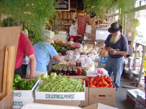
The 2nd Street Market
In 2001, a location was found. Five Rivers MetroParks purchased and remodeled a 500-foot-long, 20-foot-wide 1911 B&O outbound building, which had multiple bays that once served freight trains. The new structure, near the existing River Market and just east of Fifth Third Field, offered more electric outlets, restrooms, running water, and it will be heated with forced air, and plenty of space for the 40-plus vendors now coming to the market weekly.
The year-round National City Second Street Public Market was opened in November 2001 as a 3-day market. The roster of market vendors continued to grow: On summer Saturdays, up to 50 farmers, bakers and artisans filled the building and outdoor space around it. The market attendance also continued to grow.
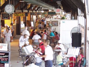
The 2nd Street Market
In 2007, the pavilion of the east end of the Market was added as a flexible place for seating and additional vendor space.
Today, the year-round Market continues to offer shoppers a wide selection of locally grown produce, sustainable goods and fresh ready-to-eat fare. It has become a community gathering place. It also serves as business incubator, spinning off vendors who have outgrown the market’s vendor stalls and moved on to larger, independent operations.
Before it was a MetroPark
The Market building was built in 1911 as a railroad freight depot by Requarth Lumber, who is still in business just a few blocks away. It was primarily used by the B&O railroad. The depot consisted of two buildings, inbound and outbound freight depots, one was the present 2nd Street Market, and one was the Webster Street Market building next door. There were 6 sets of tracks between the buildings. You can still see the embankments at the west end of the parking lot today.
Both buildings survived the Great Dayton Flood of 1913 with water reaching up to nearly 10 feet on the interior walls.
The railroad tracks were elevated in the late 1930’s to their current location behind the Market, making their use as a train depot obsolete. The Market building was converted to a vehicular freight depot until the mid 1980’s, after which time it was abandoned. The building deteriorated and was used as a haunted house in the years it sat vacant before being purchased by MetroParks in 2001.
Aullwood Garden
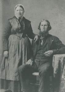
In 1977, Marie Aull conveyed her cottage home, a 30-acre garden, and a maintenance endowment to Five Rivers MetroParks, with the provision that she be able to reside on the property as long as she lived, while keeping her garden open to the public. Marie continued to direct the work of the gardeners after the donation of Aullwood Garden to MetroParks. Despite the help of gardeners, Marie could not resist working in the garden herself, even at age 90. Mrs. Aull was a familiar figure to those who visited her gardens.
She broke her hip in famous fashion in 1986, at the age of 90, after losing her footing while crossing a creek. Her accident happened about 3 p.m. on a Sunday, and she was discovered by a gardner at 7:30 a.m. the next day. Asked by a friend how she spent the night, `she said she enjoyed the stars and the moon,’ according to Marvin Olinsky, former chief executive of the park district. She lived in the cottage until her death in 2002, at the age of 105. Robert Siebenthaler, a longtime friend of Mrs. Aull’s, commented on learning of her death from pneumonia: `If she’d had her wishes, she would have been weeding the garden and just fallen asleep.’
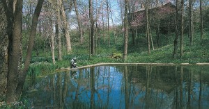
Photo by AHorvath
Aullwood Garden MetroPark continues to offer visitors a celebration of life today. At Aullwood, land, water, light and air collide with literally thousands of plants and animals to form one magnificent environment – especially in spring. Here, one can stop, if even for a moment, and recharge the inner human spirit. The staff carefully maintain the garden under the explicit plans set forth by Marie, the godmother of the environmental movement in southwestern Ohio. Her gardens are on the preservation list of The Garden Conservancy, a national nonprofit organization, dedicated to preserving some of the country’s finest old gardens.
“Dreams have always been part of Aullwood,” said Mrs. Aull, whose ashes were scattered near the 500-year-old sycamore tree in her beloved garden next to her husband’s . “I hope we will always instill in children knowledge and love of nature, so that their sense of wonder will never cease. … We all need to find something to wonder about in nature.” Her dedication to the cause of nature made Mrs. Aull a leader in national conservation efforts.
Before it was a MetroPark
Aullwood Road – 1921
John Aull, president of Aull Brothers Box Company and member of the Dayton Bicycle Club, purchased a cabin with 150 acres of farm land along the Stillwater River in 1907 as a weekend retreat from the city. Shortly after his marriage to Marie Sturwold Aull in 1923, he expanded and remodeled the cabin and moved his bride to live on the banks of the Stillwater year-round.
They started planting wildflowers as a past-time together. They spent several decades carefully building and nurturing their small valley. They spent weekends going around the countryside finding flowers that they could bring in and get started. They cultivated gardens along the woodlands and stream terraces, planting varieties from hepaticas, Dutchman’s breeches and celandine poppies. Together, they carefully placed thousands of daffodils, Virginia bluebells, spring aconites, hellebores, hostas, and old-fashioned hyacinths in the rich, woodland soil.
John passed away in 1955. After his death, Marie donated 75 acres of their farm to the Audubon Society to establish an environmental center – which has since expanded into the Aullwood Audubon Center and Farm. All the while that Marie was supervising the development of Aullwood Audubon Center and Farm, she also continued to manage her garden, often just called “Mrs. Aull’s garden.” She did so until 1977 when she gave her home and the surrounding gardens to the park district.
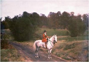
Carriage Hill
Carriage Hill MetroPark was the first park established by the new park district back in April 1965, when the district bought 224 acres with donated funds, mainly from Eugene Kettering. The land was targeted for its proximity to Huber Heights, the most rapidly growing section of the metropolitan area – and the most in need of open space preservation.
The park was originally named Drylick Run, derived from the small stream running through the property. The rolling terrain, of which was 70 acres of mature forest and meadows, was well suited to nature trails, hiking, camping, picnics, horseback riding and related activities. At the time of purchase, there was also consideration of adding a golf course and swimming facilities. However, the main focus was preserving trees, flowers, birds and animals on the land – and offering local schools a place to study nature.
Carriage Hill in 1970
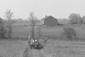
In 1968, the adjacent 97 acre property including an historic farm was purchased and turned into an outdoor education center intended to educate the public on our region’s agricultural heritage. Richard Lawwill decided the farm needed a name. One day while driving down the road, he saw a small sign with the words Carriage Hill on it. Lawwill liked how that sounded and took the name for the historic farm. Dane Mutter began the popular Springtime and Autumn on the Farm programs in 1970, partnering with the Montgomery County Historical Society to showcase life on the farm in the 1880′s. The Friends of Carriage Hill was founded in 1974 to provide financial assistance for the farm and its programming.
In 1976, the park district developed a new master plan for Drylick Run including the farm, and applied for the National Register of Historic Places – which it later received. During this process, the name of the park itself was changed to Carriage Hill Reserve.
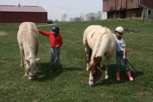
Riding Center
Since 1976, the park has expanded to over 1,000 acres of land rich in cultural and natural history. In 1995, an adjacent horse farm was also added to the park, enabling the district to offer a riding center to the public in 1996.
Carriage Hill continues to offer a glimpse of living farm history, as well as opportunities for environmental education and recreation on its stream-threaded nature trails, woodlands, croplands and meadows.
Before it was a MetroPark
The Arnolds
In 1830, Daniel and Catharine Arnold, of Rockingham County, Virginia, along with their five children, decided to move west. They sold their land, packed their possessions in a wagon, and set off for Ohio. After a long journey by ox and wagon, they settled along Dry Run, a tributary of the Mad River. The property they settled on was initially purchased by Henry Harshbarger, Catharine Arnold’s father, in 1830. Upon arriving, the family moved into a log house previously built on the site. In the spring, Daniel Arnold bought 158 acres from his father-in-law for $2,000. A new house was finished by the Arnold Family in 1836 using bricks from a nearby kiln and lumber.
Prior to his father’s death in 1864, Henry H. Arnold, the youngest of the Arnold sons, had purchased 144 acres of the old Arnold farmstead from his father. With Henry as the owner, the farm would see much growth and prosperity in the years ahead. In 1878, Henry Arnold accomplished two major additions to the farm. First, a new addition was added on to the original brick house, featuring a winter kitchen. Second, a new barn was built to house both livestock and crops. Throughout the 1880s, the farm remained extremely productive and prosperous.
Dry Lick
In 1891, Henry Arnold’s son, Henry C. Arnold married Sally Deeter, and the newlyweds set up housekeeping in the Daniel Arnold House. Henry Arnold then moved into the original log house at the farm. Henry C. Arnold tended to the farm until 1908 when he moved to Covington, Ohio to settle his own farm.
Emma Arnold then took care of the old Arnold Farmstead, even after the death of her father, Henry Arnold, in 1910. Finally in 1916, Emma Arnold sold off her family’s farm and moved to Dayton. After passing through several families’ hands, the farm was eventually acquired by the Dayton-Montgomery County Park District, now known as Five Rivers MetroParks, in 1968.
Cox Arboretum
In the early 1970s, Cox Arboretum Foundation members Harry Price and Horace Huffman began to consider ways to assure the long term survival and continuing growth of the James M. Cox, Jr. Arboretum. The presence of Dick Lawwill (Park District Director) and Harry Price (Park District Commissioner) on the Cox Arboretum Foundation Board led to discussions concerning the Arboretum-Park District relationship.
Shrub Garden in 1971
In 1972, the James M. Cox, Jr. Arboretum Foundation gifted the Arboretum to Five Rivers MetroParks and began a unique and successful public (MetroParks) / private partnership. Fundraising by the Foundation supported the needs for full-time staffing and the construction of educational and maintenance facilities, while MetroParks managed the operation.
Fundraising continued through 1970s, leading to the construction of a visitors center in 1979. A new master plan was developed in 1981 including a new water garden and deck next to the center, as well as new gardens for wildflowers, hostas and ferns, a crabapple allee, the Monet Bridge, and the edible landscape garden. The park blossomed into nearly 200 acres of beautiful gardens, woodlands, prairies and natural areas. The addition of a new park director, Marvin Olinsky, brought the Arb their first year-long calendar of events. The Arb’s collections and plantings were also expanded, including thousands of bulbs that were funded by a large gift from Frank and Nancy Zorniger.
By 1989, the increasing education programs at the Arb were out-growing their existing visitor center. A committee was formed to identify needs – by April, 1990 the Executive Committee concluded that the Arboretum needed a new Master Plan. The following years brought staged improvements to the park based on the plan, including land stewardship practices for each habitat of the park. The plan also envisioned a new visitor center complex as “a series of low connected buildings, or a single building with a courtyard, to accommodate the needs of administration, orientation, classrooms, library, restaurant, board room, utilities, etc.”
Zorniger Education Campus upon completion
After years of fundraising and planning, the Arboretum unveiled the Zorniger Education Campus in 2004, including a new education center, outdoor classrooms, a learning lab, library and volunteer center, grow house and maintenance building. This set the stage for expanded classes, camps, exhibitions, festivals and special events. But work was not done. In 2006, the Master Plan returned to the forefront of Arboretum attention, this time on the landscape design far into the future. World renowned landscape architect François Goffinet was hired to create this plan.
The Butterfly House opened to the public in the summer of 1998. At that time, it was one of only four such facilities in the United States. Now there are many butterfly houses and exhibits throughout the U.S. and the world, but Cox Arboretum MetroPark’s Butterfly House remained one of the few that exhibits all native butterflies.
An Iris Garden was dedicated in 2009, and an observation Tree Tower opened in 2012.
Butterfly House
Today, as the arboretum celebrates its 50th anniversary, it remains a special place for visitors to escape among trees, shrubs, specialty gardens, mature forests, and prairies. The arboretum hosts year-round educational programs that teach children and adults about sustainable horticulture, plant science, and conservation. It has been developed to a degree so elevated from its origins as to leave in delighted disbelief those who had known the place, an almost barren one-time farm with badly depleted soil and a scattering of weed trees stretched out on the hills above the Miami River valley.
Before it was a MetroPark
James Cox Jr.
James M. Cox, Jr. bought a farm on the south edge of Dayton in January 1952, and 3 years later he bought the 68 acres adjacent to it. A pleasant house set back in the woods would serve as a quiet week-end retreat for him and his wife. Helen. Cox named the place Spring Running.
Cox deeded the farm to his wife after they divorced. She remarried, but died soon thereafter. Spring Running was returned to Cox in her will in 1958. He now faced the question of what to do with Spring Running. The Coxes were childless; there were no youngsters to play in its fields, explore its wooded slopes, and scramble up and down its rocky ravines. Except for the parochial school directly across Springboro Pike and the elementary school immediately to the south, almost all the surrounding land was rapidly becoming intensively developed. A home builder, Layne, made Cox a tempting offer and showed him a plan. It called for some 200 homes on small lots along curving streets surrounding a few acres to be reserved as green space where families could picnic, play, and fly kites.
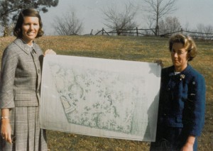
Jean Mahoney (left) and Jean Woodhull (right)
Cox shared his development plans with Jean Mahoney, a family member and avid gardener that he admired and trusted. Jean, who had been working with fellow gardeners Jean Woodhull and Marie Aull on a Save our Open Space Committee, relayed concerns to Cox, who she recalls could be an impatient man. “Well,” he barked, “go figure something out.” She prepared a thoughtful paper proposing establishment of an arboretum on the Cox property and identifying critical issues that would need to be considered. She made her request to Cox, who replied to her request with a short letter on Cox Enterprises stationery: “Congratulations. You got your Arboretum!”
On December 3, 1962, papers were filed with the Montgomery County Common Pleas Court transferring title to Spring Running to the James M. Cox, Jr. Arboretum.
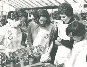
Volunteers at Cox Arboretum in the 1960′s
For many years, the property was cared for by dedicated volunteers, who also governed the Foundation. These volunteers – including Jean Mahoney, Jean Woodhull, Marie Aull and Ruth Burke – supervised the planting of lilacs, crabapples, Linden trees, pines, junipers, spruce and a collection of plants donated from Dawes Arboretum in Newark through the 1960′s.

Deed's Point
With community support and the additional funding provided by the 1994 levy, on January 1, 1995, through agreements with the City of Dayton and Miami Conservancy District, the Park District (MetroParks) added Deeds Point along with several other parks to its facilities to provide daily management, programming and security.
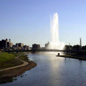
Deeds bridge and Five Rivers Fountain of Lights
After taking on Deeds Point, MetroParks added some amenities as part of the RiverScape project in 2001, and then added additional enhancements in 2003 in conjunction with the Inventing Flight celebration, a 17-day community event celebrating the 100 anniversary of flight. The hub of the celebration was held at Deeds Point and the adjacent 12 acre park. A new pedestrian bridge was added across the Mad River connecting to RiverScape, as well as landscaping, lighting, and interpretive displays honoring our local aviation history. The Friendship Force of Dayton also installed a permanent Peace Pole at the park in time for the event.
Today, Deeds Point provides great views of Downtown Dayton and the adjacent rivers. An aviation timeline exhibit serves as an ongoing reminder of the importance of the Wright Brothers and Dayton to aviation history.
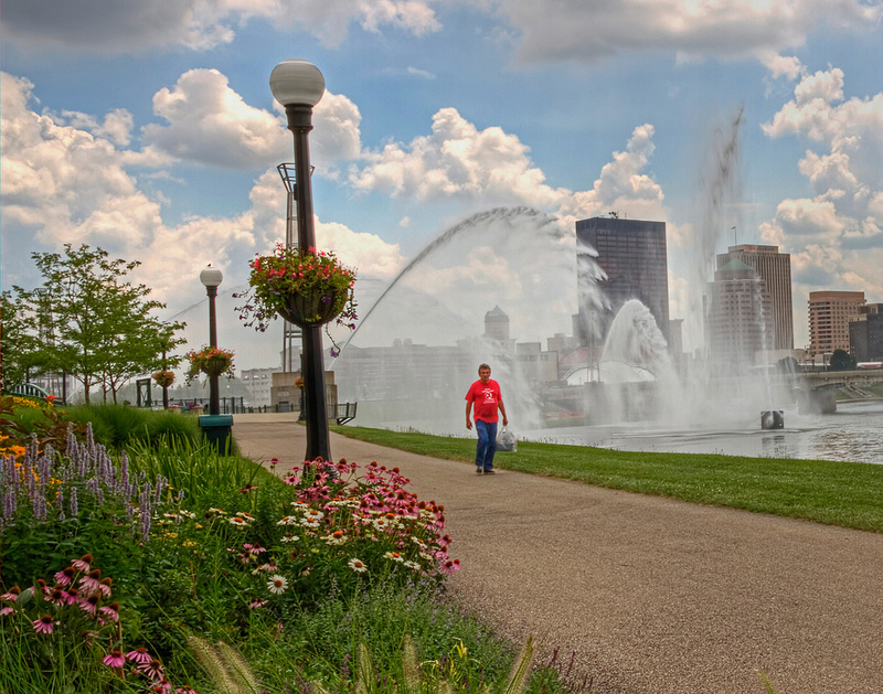
Photo by Bill Franz
Before it was a MetroPark
In 1995 when MetroParks took over management of the park, Deeds Point was a simple grassy area facing downtown Dayton at the
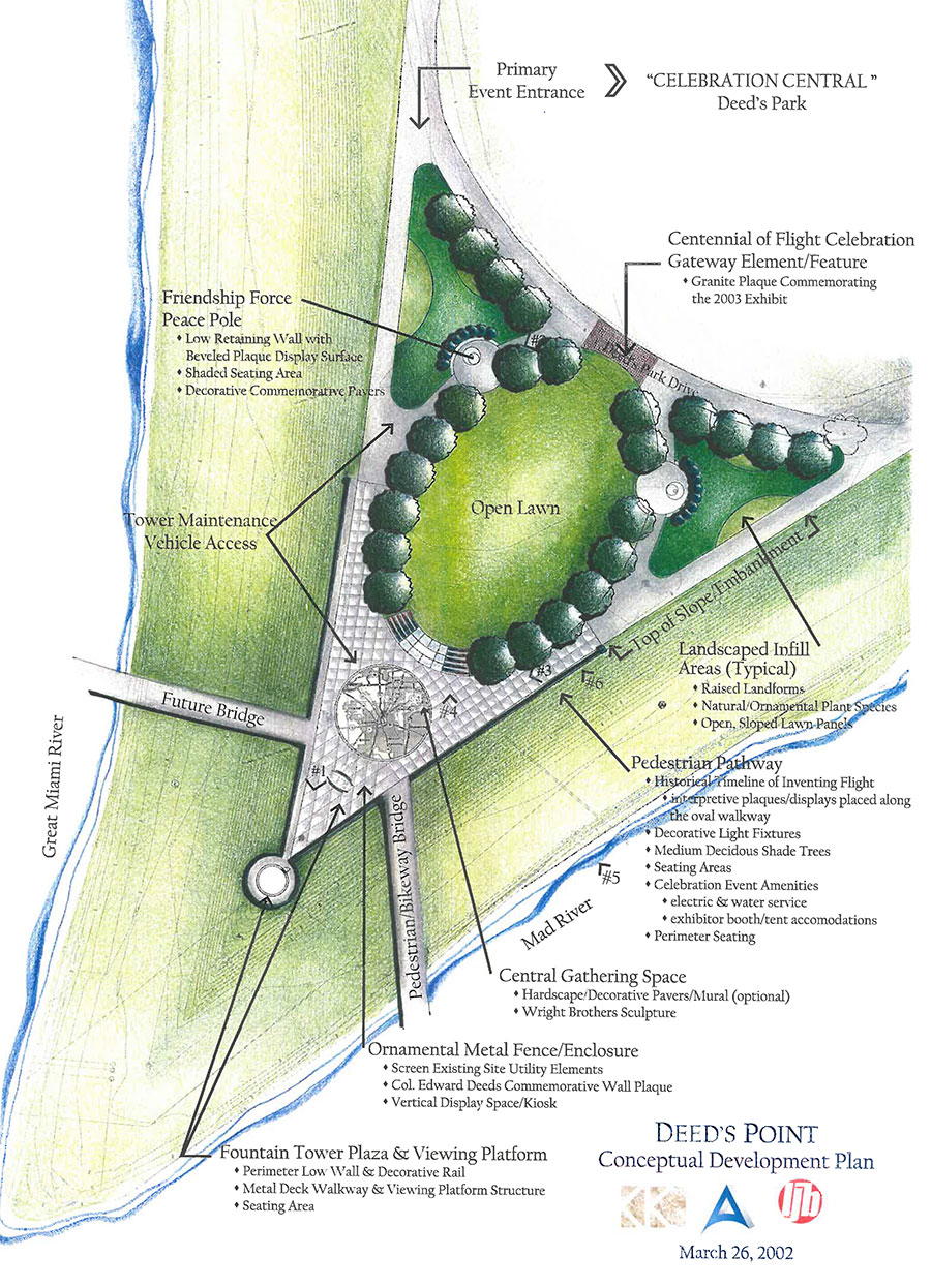
Deeds Point Plans
confluence of the Great Miami and Mad Rivers. It, and the adjacent Deeds Point Park (held by the City of Dayton), were named after Colonel Edward Deeds, a Dayton inventor and businessman who helped rebuild Dayton after the 1913 flood and was instrumental in forming the Miami Conservancy District. He served as its chairman until 1954.
Eastwood
In 1990 Five Rivers MetroParks entered into a lease agreement with the City of Dayton to allow MetroParks to manage the Eastwood Park. This action was part of a district-wide effort by then director Marvin Olinsky to offer an opportunity to serve more inner-city residents, as well as its more traditional suburban clientele the existing parks were serving at the time. Olinksy envisioned a revitalized park with areas families could reserve for picnics and other outings; walking and hiking trails; day camps for youngsters; ice skating; more use of the bikeway; quiet areas for contemplation; community-type activities such as parades, hayrides and seasonal events; and expanded boating opportunities. “I see fishing derbies for the kids in the lagoon, canoeing and paddle-boating, ice skating in the winter, quiet areas for walking, more use for bicycling and jogging, day camps and picnicking,” Olinsky said. “It will be a park second to none, and open year-round.” Presence of the district’s law enforcement rangers and maintenance personnel cut down the amount of criminal activity and crowds started coming back.
Image from DDN article
1992 the lease extended to include Eastwood Lake, formerly called the Dayton Hydrobowl. Now the Mad River’s woodsy banks on both sides were part of the new nature reserve. Again, Olinsky had a dream. “I’d like to see clusters of trees growing here along the bank, chairs and tables with umbrellas, bright-colored banners, and the concession stand open daily for light breakfasts, lunches and dinners. People who don’t want to boat could sit and look out over the water, or read a newspaper,” Olinsky said. Work began almost immediately on making the lake a better place for outdoor recreation, including improvements to boat ramps and regulating powerboat speeds for safety. The district improved the roads through the park, planted trees, enhanced signage and generally cleaned up the area. “We removed about six tons of trash – a little over 12,000 pounds, of bottles, cans, old tires, 55-gallon drums and about anything you could imagine being dumped. It was just everywhere,” said then assistant director Tim Klagge.
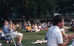
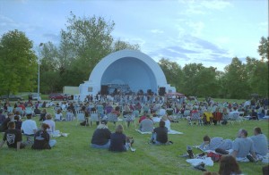
Concert at Eastwood
Since then, the park district continues to make improvements to the park to improve both the recreational aspects and the habitats for native wildlife. Access to the Mad River for kayakers was added along with a changing station, and plans are underway for a whitewater structure in the river. A Creekside Bikeway extension is set to open in the park in May that will connect Wright Patterson Air Force base to the existing bikeway that connects the park to downtown Dayton. The park also has become the home of the annual Midwest Outdoor Experience, a celebration of active outdoors lifestyles in the Miami Valley.
The district’s conservation plan for the park is also paying off. Bald Eagles have been nesting nearby in the Mad River well field since 2009 and many other species have been making reappearance in the river and woodlands, such as beaver, otter, herons, osprey, shorebirds, and gulls.
Before it was a MetroPark
 The land that Eastwood MetroPark stands on has ties back to Dayton’s very early history. In 1796, 3 separate groups of people made settlement at Dayton. One of those groups was led by Wm Hamer. After his family arrived, it is reported that in 1802, he built a grist mill, at the site of present Eastwood Park and had the whole country coming to him to grind their meal. Later records show that a Mr. Henry Leatherman built a dam in Madriver, just above the Eastwood Park in 1812.
Flash forward almost 100 years to 1913, and the devastating flood. To prevent further floods in the valley, the Miami Conservancy District was organized to prevent further floods, their action including the construction of earthen dams, including one on the Mad River just upstream from Eastwood. Much land was subject to flooding by this construction and to avoid damage suits, MCD bought up all the land subject to flood or change in any way. After construction was complete, the land was sold, subject to flooding during high water, and since the city of Dayton needed more drinking water wells and a right of way for a conduit to carry the water from the wells to the pumps, the city bought the river bed to Huffman Dam.
Eastwood Park Dam in 1944
The city formed a fine park opposite the Smithville Road in the river bed, which was opened to the public and enjoyed by many of the citizens during the summer. It was named Eastwood Park. In 1917, the city of Dayton purchased an additional 15 acres of adjacent land and a new shelter house was erected. Camps were also made available for those seeking an escape from the city.
By the 1940s, the park had become a popular spot for boating and picnicking. Its tree-shaded lagoons and large lake attract thousands during the summer months. Owing to the popularity of this park, it was necessary to build two more rentable cabins equipped with fireplaces and cooking utensils.
The rapid growth of both the civilian and the army personnel sections at Wright Field early in 1943, and the lack of recreational facilities at the field, presented quite a problem of morale to those in charge at the field. The problem of employing the leisure time of its employees profitably and happily became one of major importance. To address this issue, it was necessary to secure a location of suitable size where many outdoor activities could be conducted and which would be equipped to handle the varied interests of field employees.
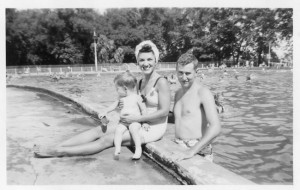
1940′s swimming pool
After investigation of the facilities available in and around Dayton, it was decided that Eastwood Park embodied most of the attractive features for which they were searching. It was located most advantageously for the greater part of the field workers, since it was on their route to and from work. It was decided to approach the City of Dayton with a view toward acquiring the park facilities for recreational purposes. A series of conferences with City officials resulted in the seasonal reservation of the facilities on Tuesday, Wednesday and Thursday of each week.
To the park’s existing facilities were added badminton, volley ball and horseshoe courts. The softball field was reconditioned and put in good playing condition. The swimming pool (at the site of the now lagoon), which had not been used for swimming for several years was placed at the disposal of those who were interested in Bait Casting. Boating was available to all participants. All picnic shelters were reserved to employees on the three nights names and many departmental, group, and family picnics were enjoyed. At no time was the park restricted to the sole use of Wright Field employees. It was open at all times for the enjoyment of all the people of Dayton, which provided the Field employees an opportunity to become acquainted with others person not employed at the Field.
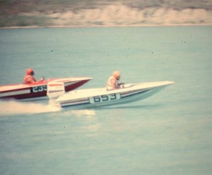
Photo copyright Hurst via hydrostream.org
In 1972 the lake on the other side of the Mad River was completed (a by product of the American Aggregate Corporation’s mining). The lake held two functions: one was to provide water recreation for the community and also to help protect the city’s water supply by acting as a recharge basin for the aquifer. The lake, known as the “Hydrobowl” became a popular spot for boating and even rock concerts in the 1970s.
Although a popular spot for organized rugby and soccer games, disc golf and the annual Mountain Days Festival, Eastwood had become a burden to the city during the 1980s as budget cuts reduced staff, maintenance and security patrols, and as vandalism and criminal activity increased.
Englewood
Englewood Reserve was opened to the public on April 1, 1967. The land, part of the Stillwater River flood control system created in 1922 by the Miami Conservancy District, was leased in 1966 by Paul Lacouture, who was on the park district’s task force for buying land. He negotiated a lease contract with MCD to lease not only the Englewood land, but also the reserves surrounding the dams at Germantown, Taylorsville and Huffman for nature reserves that would be open to the public year round. MCD had been working with the park district since it was formed to plan recreational use of their lands, once needed for the dam construction process. In a 1964 study, it was suggested that Englewood would be an ideal location for an 18-hole golf course, an Old National Road historical attraction, fishing, boating and picnicking facilities and more while maintaining flood control.
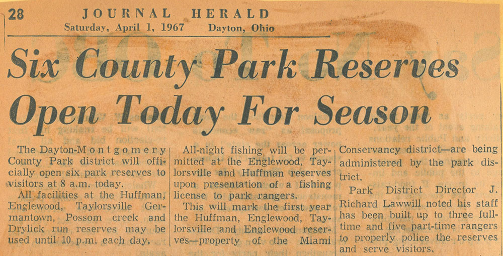
Opening Day, 1967
The land included a stream valley, mid slopes and upland plain; 150 acres of water in two borrow pits (from which material was borrowed to construct the earthen dam) and partial cover of natural woodland and red and Scotch pine plantings providing an excellent habitat for many birds and other wildlife. It was bisected by the Stillwater River and adjacent to the Aullwood Audubon Center and Farm.
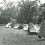
Camping – 1970′s
The park district began making improvements to the land including hiking and horseback riding trails, picnic areas, camping areas, as well as areas for small boats and fishing on the lakes. In winter there was ice skating and sledding. In 1968 they opened a riding center for horse enthusiasts and a canoe rental concession for those interested in getting on the water. They also offered camps for children each summer, including the long-lasting camp Thunderbird, the district’s first overnight camping experience led by Art Van Atta.
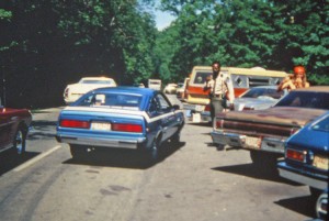
Cruise-in, 1970′s and a full park
Since that time MetroParks have made several purchases of adjacent land protecting over 1900 acres from development, including woodlands, meadows, wetlands and three waterfalls. The park became so popular in the 1970s and 80s that it had to be closed at times for congestion. Other amenities continued to be added, including a sled hill, an 18-hole disc golf course, and a nature play area for children. In 2010, a low dam on the Stillwater river was removed to improve the habitat for fish populations. At one point, low dams — Englewood’s low dam was built in 1935 — were built nationwide with the thought they would create recreational space for waders and boaters. Instead, not only did the low dams present safety hazards with turbulent swift currents, they destroyed some of the ecological culture as well, lining the river bottoms to mushy silt and inhibiting fish. Along with removing the low dam, the river was lowered eight feet, which meant river access into and out of the lake also had to be adjusted. Prior to the inlet and outlet streams, Englewood Lake had no way to get fresh water.
Patty’s Falls
Englewood MetroPark continues to be one of the most visited parks in the district today. The natural areas of the park contain floodplain forests, large areas of former farmland in natural succession, second growth upland hardwood forest, significant remnants of mature and old growth forest, a large shallow lake/wetland, several managed grasslands, and the scenic Stillwater River. The park also contains series of rehabilitated gravel quarry along Old Springfield Rd (North Park). Hiking and bridle trails lead visitors to some of its most spectacular features. The main road through the park is marked with a bike lane and offers scenic cycling and a connection to the regional Stillwater Bikeway.
Before it was a MetroPark
Englewood Dam is an earthen embankment located across the Stillwater River in northern Montgomery County near the City of Englewood. U.S. 40 goes across the top of the dam. Construction of the dam began in February of 1918 and was completed in December of 1921. The land the dam was built on was sold to the Miami Conservancy District by John Aull, husband of Marie Aull the godmother of the environmental movement in southwestern Ohio and founder of nearby Aullwood Audubon Center & Farm and Aullwood Garden MetroPark.
Old buildings at Englewood
The Englewood Dam was one of the largest of its kind in the world. When completed it was destined to change the entire Stillwater Valley up as far as Covington. Southeast of Englewood where the park is now there were ten or twelve villas and farm houses that played an important part in the pioneer history of Englewood. One of the largest summer places was called Halcyon Hall was quite extensive as the ruins indicated there being a double concrete tennis court. In the days of 1930 and l940 the place resembled a ghost town, there being remains of basements, orchards, lanes, spring houses, storage cellars and flower gardens, all lonely and deserted. Englewood Dam and the greater part of the park on the west side of the river were built on land bought by Frederick Waymire from the Federal Government August 11, 1802. It therefore represents one of the earliest sections of Randolph Township settled by the pioneers.
Germantown
Germantown Reserve was opened to the public on April 1, 1967. The land, part of the Twin Creek flood control system created in 1922 by the Miami Conservancy District, was leased in 1966 by Paul Lacouture, who was on the park district’s task force for buying land. He negotiated a lease contract with MCD to lease not only the Germantown land, but also the reserves surrounding the dams at Englewood, Taylorsville and Huffman for nature reserves that would be open to the public year round. MCD had been working with the park district since it was formed to plan recreational use of their lands, once needed for the dam construction process. In a 1964 study, it was suggested that Germantown would be an ideal location for nature exploration and recreation while maintaining flood control.
Picnic in the park, 1965
The rugged Twin Valley included uplands forested with virgin timber including Tulip, Oak, Hickory and Ash as well as midslopes and ravines featuring Butternut, Beech, Elm, Dogwood, Sugar Maple and Black Walnut. The flood prone bottomlands were home to Silver Maple, Sycamore, Box Elder and Cottonwood. It also included a beautiful stand of eastern red cedars, some especially large. This variety of habitats made the region an excellent home for a variety of native plant materials and wildlife.
The park district began making improvements to the land including hiking trails, picnic areas, fishing and camping areas.
Underground Nature Center, 1980
The underground nature center was built in 1980. Designed to help visitors better understand the park’s outstanding natural features, the Nature Center is also as an environmentally friendly structure. The building is mostly underground and heated and cooled primarily by a heat pump system.
Efforts began on restoring hillside prairie habitats in 1982, after a small prairie remnant was discovered in the park. A prairie seed nursery was established on site in 1992 through a partnership with the Ohio Department of Transportation to grow native plants to decorate the state’s highways. A program that continues today, and that spurred wildflower `farming’ and restoration across all the MetroParks that originally had native prairies.
In 2009, the district opened their first backpacking trail stretching from Germantown to Twin Creek MetroPark. The Twin Valley Backpacking Trail combines the existing network of trails in Germantown and Twin Creek MetroParks with a connection to create a longer, more integrated trail system totaling over 43 miles throughout 2600 acres and secluded backcountry camping that allows everyone to experience the wilds of the Twin Valley.

Fall at Germantown MetroPark
Today, Germantown MetroPark is the most diverse and significant natural area managed by MetroParks. The size, quality, and age of the woodlands are exceptional. Steep topography and varied moisture gradients make for a variety of forest types and microhabitats. Many species of plants and animals here are found nowhere else in Montgomery County. The park also contains large open grasslands, cedar glades, dry hillside prairies, and all stages of natural succession, several ponds, and an exceptionally high quality stream, Twin Creek. The park also benefits from the fact that it still is surrounded largely by agricultural land and the wooded Twin Creek corridor.
Before it was a MetroPark
Sprint House Camp at Germantown Dam, 1936
Germantown Dam is an earthen embankment located across Twin Creek in southwestern Montgomery County near the Village of Germantown. Conservancy Road goes across the top of the dam. Construction of the dam began in March of 1918 and was completed in November of 1920. In the 1930’s, the heavily wooded areas above and below the dam were set aside for public use and enjoyment by the Miami Conservancy District. The Civilian Conservation Corps (CCC) and Works Progress Administration (WPA) projects built shelters, picnic areas, graded roads and built hiking trails along Twin Creek during the depression era.
Hills & Dales
Hills & Dales became a MetroPark in 1999. As part of their 2000 levy commitment, the district promised the community that they would take on and restore the neglected but historic park back to its former glory.
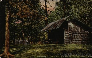
A postcard of the Adirondack Camp
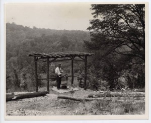
After years of construction and master planning, $4 million in improvements were unveiled to park goers in 2009, including new shelters in the Adirondack style of the original park, new restrooms, a restored Patterson monument, boardwalk, restored pond, extensive honeysuckle removal, playgrounds and increased monitoring and law enforcement. The park now feels like a ramble through a thickly wooded upstate New York forest, a visit to a bygone era when Adirondack architecture was all the rage, a place and mind-set where visitors became part of the landscape and weren’t there as intruders. It’s ideally suited for casual strolls and photography. The reservable shelters are among the most popular in the district.
Before it was a MetroPark
John H. Patterson, founder of National Cash Register Company, believed that education and outdoor exercise were the pillars of good health for not only himself, but also his employees. In the early 1900s, Patterson owned hundreds of acres south of Dayton. He knew the community could benefit from planned green space for leisure activities. Patterson hired John Charles Olmsted and Frederick Law Olmsted Jr., the sons of world famous landscape architect, Frederick Law Olmsted responsible for the design of Central Park in New York City, to work their magic on the natural terrain. Patterson began a relationship with the Olmsted Brothers in 1894 after developing a strong appreciation for their “natural school” of landscaping gardening.
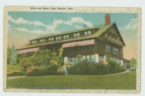
The Hills and Dales Club
The results of their work at Hills and Dales were picturesque creeks, trails for riding and walking, sugar maples, wild flowers and the fragrance of honeysuckle.
Hills & Dales Park must have been a novel experience for most Daytonians when it opened in 1907. With its carefully designed meadows, water, and woods, it was meant to recreate, in gardens, the perfection found in nature. It was intended to provide a place for city dwellers to conveniently enjoy beautiful natural scenery and obtain relief from the nervous strain of urban life.
In its early days, park goers could take a short ride from the city and be immersed in nature. Visitors strolled walking paths on foot or horse. They picked blackberries, wild strawberries, May apples, walnuts and hickory nuts and ate them on the grounds. They lingered near wading pools and picnicked in Adirondack camps.

One of Omsted’s original bridges
In 1918, confident that the city of Dayton could care for it, Patterson deeded the park to the public, although the property was outside the city limits.
Families were attracted to Hills and Dales in the 1920s, as a welcome change from city living. The Old Barn Club, located along Patterson Boulevard just north of West Dorothy Lane, was the hub of the social and cultural life of the people of the Miami Valley – it a most desirable place to use for wedding receptions, organization meetings and family gatherings. It had brown, stained clapboard siding and resembled a Swiss chalet with porches on several sides. A series of steps from the road turned into a large sitting room two stories in height around which ran a balcony. Wicker furniture, rockers and high-backed chairs faced an alcove with a large fireplace and a player piano. There was a natural amphitheater for Sunday afternoon concerts by local artists, and Sunday meals were open to the public.
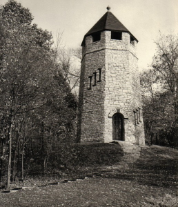
The tower nicknamed “Frankenstein’s Castle”
The Old Barn Club was destroyed by fire in the late 1920s. By the early 1930s, the park lands started to be chipped away. The series of open meadows, polo fields and open air theatre were converted to golf course; eastern sections were subdivided for housing development. This left only a small sliver of natural park along the ridgeline directly east of the golf course.
John H. Patterson, co-founder of National Cash Register Company, believed education, recreation, and outdoor exercise were the pillars of good health. A memorial to Patterson was erected in the 1920s and stands in the heart of Hills & Dales to honor his leadership. The bronze and granite monument by Italian sculptor Giovanni Morretti places Patterson and his favorite horse, Spinner, at the top of the hill where he often rode on the bridle paths. Allegorical figures representing prosperity, progress, industry, and education also are included to represent Patterson’s influence on the community.
Bridle Trail circa 1913
Known by a number of names, including Frankenstein’s Castle, Patterson’s Castle, and the Witch’s Tower, the tower at the park was constructed of stone salvaged from condemned buildings by the National Youth Administration (NYA) as a project during the Great Depression and finished in 1941.
By 1990′s, the original character of what was left of the site had been transformed by years of vegetation growth. Almost 90 percent of the natural areas were overgrown with Amur honeysuckle. In 1993, the City of Dayton completed a study of the historic property in conjunction with Ball State University and published a document entitled “Hills and Dales Park Historic Landscape Preservation Master Plan.”
A group of concerned citizens named “Friends of Hills & Dales Park” started a cleanup effort in the late 1980′s, anchored around cleanup days where volunteers cleared huge amounts of honeysuckle, painted shelters, planted bulbs and performed general clean up. The group, led by Dayton Garden Club member and MetroParks commissioner Jean Woodhull, continued with cleanups and bulb planting well into the 1990′s. Woodhull’s passion for Hills & Dales had a significant impact on the MetroParks decision to assume operations and maintenance in 1999.
Huffman
Huffman Reserve was opened to the public on April 1, 1967. The land, part of the Mad River flood control system created in 1922 by the Miami Conservancy District, was leased in 1966 by Paul Lacouture, who was on the park district’s task force for buying land. He negotiated a lease contract with MCD to lease not only the Huffman land, but also the reserves surrounding the dams at Englewood, Taylorsville and Germantown for nature reserves that would be open to the public year round. MCD had been working with the park district since it was formed to plan recreational use of their lands, once needed for the dam construction process. In a 1964 study, it was suggested that Huffman would be an ideal location for picnicking, hiking and nature study while maintaining flood control. The 30 acre lake (which was created by removing earth for the construction of the dam) offered opportunities for fishing, small boats and ice skating in winter.
 The Huffman land was almost surrounded by the Wright-Patterson Air Force Base, meaning that enlarging it over time would be unlikely. The park district maximized the land they had, adding picnic areas, fishing and a boat launch on the eastern portion of the land in the Mad River flood plain. The flat land was mixed cover of woody vegetation and mowed grass areas perfect for Frisbee or volleyball at picnics.
Bisected by a busy Route 4, the western portion of the site consisted of relatively steep and swampy topography. This portion had been set aside for the motorcycling community by MCD in 1966. When the district took over the lands, this use was in direct conflict with the natural habitat preservation philosophy. A park district ranger counted over 800 motorcycles in the Huffman reservoir area in a single day in that first year. These motorcycles left mud holes, deep ruts and damaged vegetation, along with creating noise and air pollution. Because of the elevation, this portion of the park offered some of the most spectacular views – something the district wanted to share and protect, along with a fine stand of oak, maple and hickory trees. In 1969, the park board approved to reduce the area available to cyclists and separate it from the adjacent hillside and wooded valley with barriers in order to preserve the natural habitats for day camping, nature walks and interpretation. Cyclists, dirt bike users and other off-road vehicles continued to use their portion of this land until 1987 when a new master plan for the park was developed and adopted, barring such use due to the soil erosion, siltation of Huffman Lake and encroachment on adjacent private property that the activity was causing. This land then rested until 2007 when it was re-opened as the MetroParks Mountain Biking Area (MoMBA). The Mountain Biking Area was build with the help of more than 60 volunteers who put in close to 3,000 hours working in the woods building over 8 miles of sustainable trails for the kinder and gentler people-powered bikes, not motor-powered bikes of yester year.
Today Huffman MetroPark is managed for natural diversity, from the wooded meadows to the river bottom lands to some old growth forest located in the MoMBA section of the park. The habitats draw many migrating birds including many species of ducks, gulls, herons, song birds, woodpeckers, and birds of prey. Visitors to the park enjoy some of the best fishing in the region, as well as places to hike, picnic and mountain bike. Later this year, the Mad River Bikeway extension will connect the park to Eastwood and the 300+ mile regional bikeway network.
Before it was a MetroPark
The Huffman Prairie extended over what are now Huffman MetroPark and the adjacent land that is part of Wright Patterson Air Force Base. It was on this prairie area that Orville Wright recommended in 1917 that a large air field be constructed. It was also the location where the Wright brothers conducted their second successful flight. A memorial to the Wright Brothers is maintained by the Air Force on base property. Sited on a high bluff, just east of State Route 444, the memorial overlooks the dam and park. Remnants of the original prairie can be found on the base in a small area below the dam.
The site of the Huffman dam was once the town of Osborn. About 200 wood frame homes were moved to higher ground in 1922 to make way for the Miami Conservancy District’s Huffman Dam flood plain. The relocation of Osborn, which merged in 1950 with neighboring Fairfield to become Fairborn, was one of the biggest local consequences of the great flood of 1913. The construction of the earthen dam across the Mad River began in January of 1918 and was completed in December of 1921.
Between 1827 and 1830 a portion of the now park was set up what became known as Kneisly Station. It was settled by John Kneisly, who eventually owned about 1,200 acres, much of which became part of the Huffman Prairie land. The family’s history book shows John had a daughter, Catherine, and son, George, both of whom died in 1828 and were buried in the family cemetery on land now within the park.
On July 28, 1838, the first and largest company of Mormon pioneers to migrate west camped along the Mad River near what is now Huffman MetroPark. Known as Kirtland Camp, the 515 members of The Church of Jesus Christ of Latter-day Saints (Mormons) appeared as a train of 59 covered wagons and 189 head of livestock stretching a distance of 9 miles. They were heading to Missouri from Kirtland, Ohio. The migrants fled religious persecution and sought new homes and religious freedom. They sought respite here during the journey. To earn money, the Saints accepted various jobs. These included building dykes and levees, and half-mile section of Springfield-Dayton Turnpike. The Saints resumed their trek on August 29, 1838. The bodies of 5 children who died during the encampment on the Mad River are buried here.
Island
With community support and the additional funding provided by the 1994 levy, on January 1, 1995, through agreements with the City of Dayton and Miami Conservancy District, the Park District (MetroParks) added Island Park, along with Van Cleve Park, Deeds Point, Wesleyan Nature Center, Sunrise Park, Wegerzyn Horticultural Center and the river corridor areas to its facilities to provide daily management, programming and security. MetroParks started the rehabilitation of the park to protect the character set forth by Patterson & the Olmsted’s.
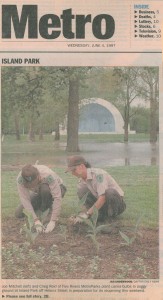
1997 photo about the reopening
When the district took over maintenance, Island Park began its restoration, including new shelters, new restrooms, playgrounds and increased monitoring and law enforcement. They removed the decaying rows of benches that for more than 50 years gave listeners a place to sit for performances at the band shell. They protected the outstanding specimen trees of floodplain forests such as sycamore, cottonwood, burr, oak, American elm and their surroundings as a habitat for the many migratory birds and animals such as Beavers and soft-shell turtles.
The park now offers amenities needed for today’s active and healthy lifestyles as well. A partnership with the Greater Dayton Rowing Association offers rowing opportunism in the southern portion of the park, carrying on a 100 year old tradition of regattas on the river. The Great Miami River Bikeway runs through the park, connecting to a network of more than 300 miles of paved bike trails in the region. A portion of the National North Country Trail and Statewide Buckeye Trail, also traverse the park, offering thru hiker an urban oasis. People from all over the area gather for community events, picnics and family fun in the water play area. Nature lovers seek the beauty and peace of this oasis in the city.
Before it was a MetroPark
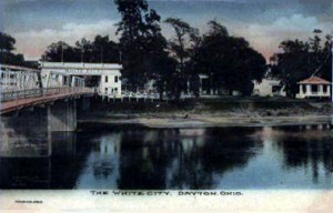
Island Park circa 1910
Island MetroPark was formerly known as the White City Amusement Park in the late 19th century. The park had a dance pavilion, amusement rides, canoe lockers, refreshment stand, and other recreation features. By 1907 the park had become run down and not well maintained. In 1910, Dayton started leasing the park land for $3,000 a year, and in 1911, a recommendation to buy the land was proposed in the report submitted by the Olmsted Brothers; world renowned and famous for enhancing the natural beauty of urban sites with their designs. It’s noteworthy that the whole report stems from the urging of John Patterson (co-founder of the National Cash Register Company).
The Great Flood of 1913 left the Dayton area incapacitated and knocked out the bridge that allowed passage; and damaged a number of buildings at the White City Amusement Park. Because of the park was located in a flood area there was initially no redeeming quality to replace the bridge that connected the park at Helena Street to the Main St. car line.

Boating at Island Park
Then, on July 13, 1913, the Dayton Canoe Club held its first regatta. D.W. Begley the owner to the boathouse across from White City Park ferried spectators across the river free of charge. Consequently, after two more successful regattas’ that summer the Dayton city officials decided to rebuild White City. On June 20, 1914, the park formally opened as Island Park. The park became an ideal location in the coming years for programming that included bathing, picnicking, canoeing, boating, dancing, ice skating, water carnivals, evening band concerts, and general recreation.
In the 1920s, Dayton’s municipal leaders were keeping a watchful eye on a potential den of decadence, at the Island Park dance pavilion. Only the year before the nation had decided to improve its moral fiber with “the noble experiment” known as Prohibition, outlawing the sale and consumption of alcoholic beverages. A report to City Manager J. E. Barlow warned of the “slow, sensuous character of the music” being played at the pavilion and the “suggestive movements” of the dancers. A Dayton Daily News article of July 10, 1920, carried the headline: “Shimmy Music at Island Park; Conditions Bad.”
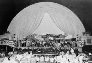
Performance in the band shell circa 1955
In 1940, a Band shell was erected, and opened under the name of the Leslie L. Diehl Band shell where programmed concert attendance totaled 80,000 in 1943. One account in 1940 said “Canoeing is one of the popular forms of recreation in Island Park. For the benefit of the canoeists, new lockers which will house about 382 canoes were constructed. In addition, since this park is also used by many groups of picnickers, a new shelter house was built. Band concerts at Island Park have been provided for many years. A new band shell was completed this year which is one of the finest in the country. Many thousands have enjoyed the concerts and other entertainments during the past season. It is estimated that crowds from 8,000 to 12,000 in a single evening have enjoyed the concerts.”
Bud Abbott and Lou Costello, a film comedy team, filled Island Park on August 16, 1942 when they arrived to help build interest in the war bond and stamp campaign. More than 20,000 people came to watch the two men clown around.
A concert at the band shell in the 1990s
In the 1970s and 80s, Island became the home of large festivals like Dayton River Festival each Memorial Day weekend. Over the years, the festival featured music, food, entertainment and activities, including water sports on the Stillwater River. The event usually drew 60,000 to 70,000 people. A ban was placed on fireworks after a shell exploded in the crowd at the 1988 River Festival, injuring 27 people. This caused declining attendance and eventually killed the festival.
In the 1990s the park was home to the Dayton Black Cultural and Fly City Festivals.
Dayton official annual reports reveal a pattern of heavy use and evolution of the park and it shows that through war and peace, prosperity and urban challenge, Island Park remained a focal point of Dayton recreation for decades.
Possum Creek
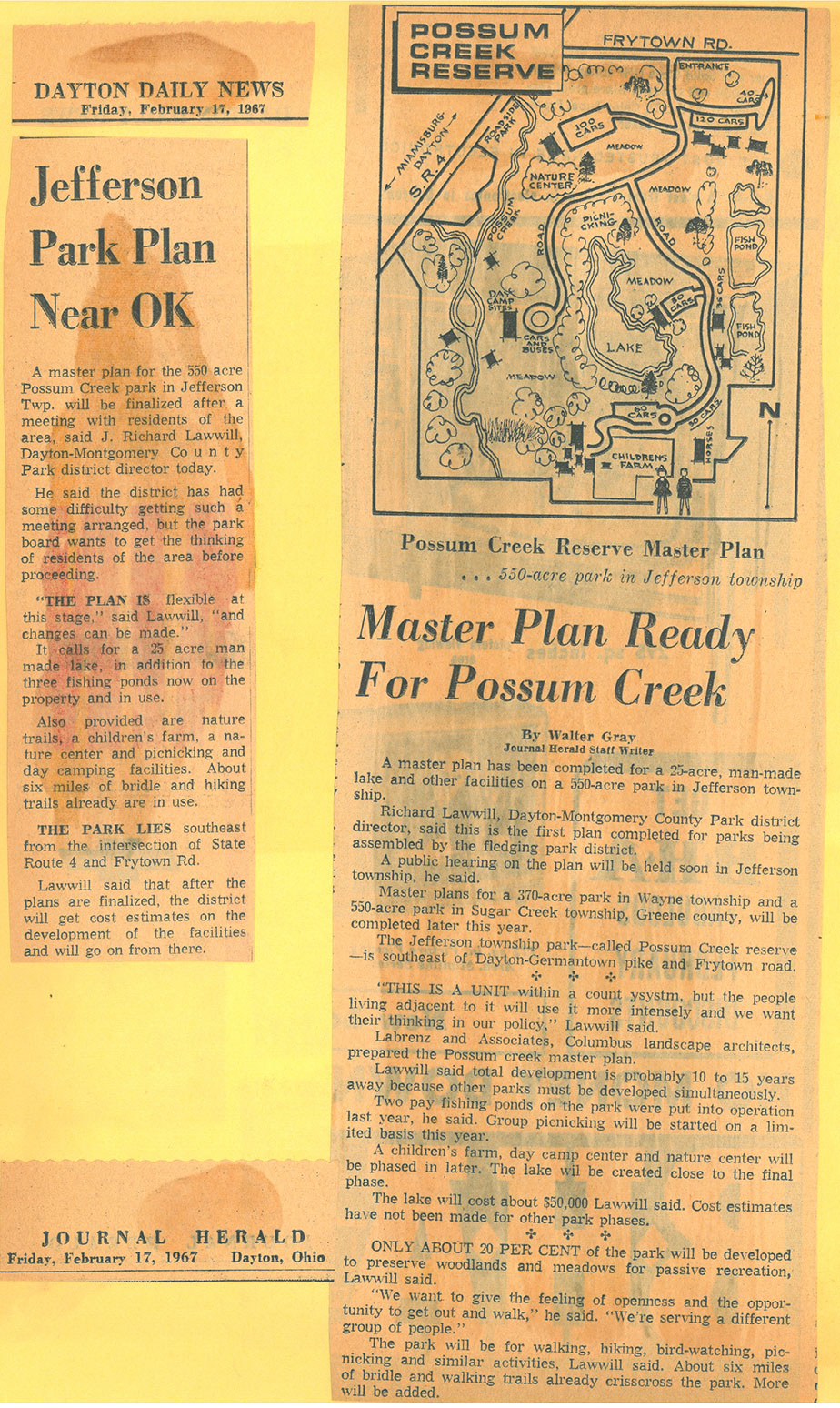
Master plan explained in articles
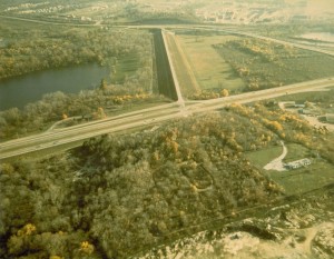
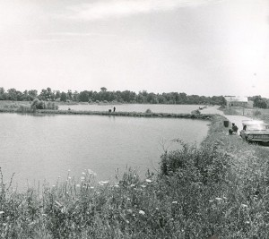
Possum Creek is one of Five Rivers MetroParks’ earliest parks. Its scenic land was outlined in the Montgomery-Greene County Open Space Study Report of 1959 as a stream-side park that would serve Dayton’s southwestern metropolitan area. In early 1967, a master plan was finalized for a 550 acre tract of land in the area calling for a manmade lake, fishing ponds, nature trails a children’s farm, nature center, picnicking and day camping facilities on this rich bottom land traversed by the Possum Creek. At the time, the site already included about 6 miles of bridle and hiking trails as well as three fishing ponds and the remnants of an old amusement park called Argonne Forest Park. It also included rolling meadows, ponds and woodland. A nightclub, formerly known as the Chi Chi, also sat on the property. It was converted into Sycamore Lodge, to be used for social and educational functions, holding up to 300 people.
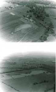
Aerial view circa 1968
The lands acquired in the original purchase included a 150-year-old farm. District staff saw this farm as an opportunity to educate the public on the agricultural heritage of our region and began to make improvements the grounds to turn it into a rural life center, depicting an authentic and working farm of the 1880s. The buildings were stabilized, farm pond and orchards were added, and new roads were paved. In 1968, an open house was held on the farm. In the years that followed, Summertime and Wintertime on the Farm programs were added, as well as demonstrations of barn building and grain threshing. Schools began to send their students out for tours and demonstrations in the early 70s, and a partnership with 4H grew strong. The farm increased in popularity as a great place for children. Gardening programs were also offered, including community garden plots for those that did not have space of their own to garden and specialty programs for seniors.
Fishing ponds circa 1966
The campsites in the park became very popular with scouts and local churches. The fishing lakes, however, were the most significant draw in the park – bringing in nearly 45,000 people in the first 5 years. In 1974, a community advisory committee was formed to help the district in planning and development in order to make the park more meaningful to the community. Sycamore Lodge was used regularly by groups like the 4H, local schools, even Miami University.
In 1977, an update was made to the original 1967 master plan. It called for further renovation of the farm, including the construction of picnic shelter, a bird blind, and to finally construct the man-made lake called for in the original plan. Other ideas included playgrounds, a man-made ice skating rink and a motorized minibike trail.
A new 15-acre lake, named Argonne Lake after the historic Argonne Park on the land, was dug in the late 1970s to meet the growing demand for recreational activities. It was intended to provide additional opportunities for fishing, as well as non-motorized boating, ice skating, picnicking or simply a place to relax. The new lake opened, along with a new shelter and restrooms in 1984.
Children enjoying the farm area
In the 1990s, new innovative programming was added to the park’s offerings. Polly Possum’s Math Farm featured 15 stations, each offering information about one aspect of farm life. Stations included farm-related math problems with varying levels of difficulty. The math farm provided a hands-on learning environment for young people from kindergarten through high school. The staff also partnered with a local homeless shelter to offer camps for the children they served.
Possum Creek MetroPark’s significant natural features today include bottomland hardwood forests along Possum Creek, two mature beech woodlots, and numerous created ponds and wetlands. Over 100 acres of degraded farmland and dumps have been cleared and planted into native Ohio prairie. The prairie took years to establish, but now thrives on the poor ground. It is currently one of the largest and most diverse planted prairies in Ohio. The farm operations continue, although less emphasis is placed on historic farming and more on sustainable techniques in food production. It remains a popular place for fishing, camping and picnics.
Although the land that is now Possum Creek MetroPark has been dramatically changed by past land use, it stands today as a splendid example of what can be achieved with proper stewardship and restoration, and is a delightful place for the naturalist, hiker, or family.
Before it was a MetroPark

Swimming pool & baseball diamond circa 1930
Argonne Forest Park was founded in 1930 by Daytonian Null Hodapp, who returned from WWI and had a successful career as a judge in the area. Null purchased nearly 400 acres of wooded land along Germantown Pike and named the property Argonne Forest Park in honor of the Unit he served in during the war. Development of the park began with the construction of a veteran’s clubhouse. Behind the clubhouse, to the south, was a carnival-like midway. Development of the clubhouse area was followed by other additions. These included a swimming hole and diving platform, baseball diamond, shooting range, dance hall, pony and horse tracks, and a figure-eight auto race track.

Streetcars from the 1920s once sat in the park
It was not until World War II and gas rationing that crowds began to dwindle and the demise of Argonne Forest Park soon followed. After Hodapp’s death in 1945, some small parcels of land were sold off. In 1966, the park district bought the remaining land.
A part of the area today, still called Argonne Forest, is located in the northwest portion of the park. Dominated by tall beech trees, it is not unusual to hear the hoot of a great horned owl or see deer while walking the trails here. The close observer can still find hints of the original park. A low L-shaped wall, once part of the swimming pool, can still be seen and remains of three street cars are hidden on the forest floor. A large cement square, which may have been part of the dance floor, also remains. Most of the figure-eight auto track is now under a lake built by the Park District in 1979, but a hiking trail still follows portions of the old track. The building that was once the veterans’ clubhouse still stands on the southeast corner of Germantown Pike and Frytown Road. Behind it, some of the buildings that were part of the carnival midway remain.
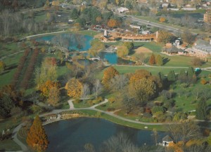
RiverScape
With community support and the additional funding provided by the 1994 levy, on January 1, 1995, through agreements with the City of Dayton and Miami Conservancy District, the Park District (MetroParks) added Van Cleve Park, along with Deeds Point, Island Park, Wesleyan Nature Center, Sunrise Park, Wegerzyn Horticultural Center and river corridor areas to its facilities to provide daily management, programming and security.
The idea of RiverScape grew out of a strong yearning to reunite downtown Dayton and the Great Miami River. Since the levees were built through downtown to corral the river after the horrific flood of 1913, Dayton has struggled with its relationship to the Great Miami River. This beautiful waterway, flourishing with wildflowers and birds in the shelter of the levee, wound through downtown Dayton while most of us barely noticed it was there. The river corridor bikeway was begun in 1976 and eventually linked to cities throughout the region, yet there was still no solid link between the river and downtown. By the 1990s, people were clamoring to get down to the river.
Reclaiming the River
Downtown Dayton needed not only to reclaim the Great Miami River, but also to reclaim downtown. Suburban sprawl had left empty storefronts and abandoned warehouses throughout downtown. The newly formed Downtown Dayton Partnership (DDP) was charged with taking on that task. At the same time, Five Rivers MetroParks had taken over Van Cleve Park from the City of Dayton and was exploring what potential lay there at the top of the levee. Through surveys and meetings, the DDP quickly learned that the public thought the best way to bring people downtown was to enhance the river’s edge. MetroParks, which had hired Belgian landscape designer Francois Goffinet, learned that Van Cleve Park had the potential to provide a beautiful and exciting downtown park. With these two goals in mind, MetroParks and the DDP partnered with The Miami Conservancy District in 1997 to develop a master plan to reconnect downtown to the river and begin downtown revitalization.
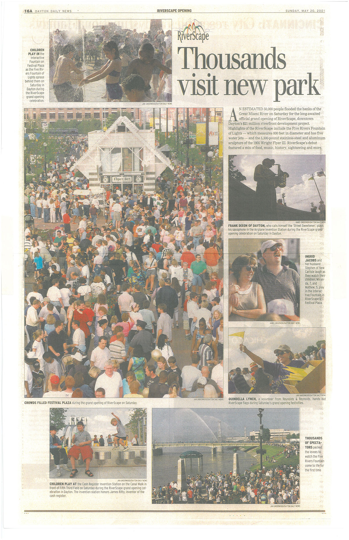
Grand Opening in 2001
RiverScape Partnership
These three organizations were soon joined by Montgomery County, the City of Dayton and the Miami Valley Regional Transit Authority (RTA) to establish the RiverScape partnership. Over $30 million was raised to fund the construction —over a third from private individuals and companies in a campaign led by David Holmes of Reynolds & Reynolds. Over the next four years, ten consultants and well over a dozen contractors worked to turn the vision into bricks and mortar, flowers and fountains. On May 19, 2001, the park opened to a crowd of 50,000, the largest crowd ever to gather in downtown Dayton. Crowds continued to grow at special events throughout the summer, but even on a Tuesday afternoon or a Sunday evening, the park bustled with hundreds of people from throughout the Miami Valley. Dayton had returned to the river.
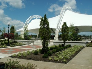
The covered pavilion at RiverScape
Phased improvements
Over the next few years, RiverScape demonstrated its value as a stable urban space in Dayton where all segments of our community come together to celebrate our local pride and socialize in a unique and beautiful setting. It became known for breathtaking landscapes, interactive fountains and free entertainment along the banks of the Great Miami River, RiverScape MetroPark has become a favorite outdoor gathering place in downtown Dayton. To support the growing public interest, a master plan was created for the paved lot where the former Sears garage stood was. In 2009, ground was broken on a performance pavilion with a stage and covered seating for festivals, community events, free entertainment or just a relaxing lunch with friends. In the winter, the pavilion would house the ice rink, allowing for expanded hours. The project also included a new bike hub with secure bike storage, showers and lockers will provide a central location for downtown commuters going to work or play. The facility opened in June 2010.

The River Run project
Opened in 2017, the RiverScape River Run brings people closer to the river. By removing a dangerous low dam, the River Run project has improved water safety, and provided a unique urban recreation opportunity by making it easier to access the river for a variety of activities. The RiverRun project completes a seven-mile stretch of paddling opportunities from Eastwood MetroPark to Carillon Park.
The completion of this phase, along with the previous three phases, will realize several of the significant features of the community’s grand river corridor plans going back to the 1970s, and strengthen Dayton’s bond with the rivers that made her.
Before it was a MetroPark
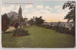
The site of RiverScape was Van Cleve Park for more than 100 years. Daniel Cooper, founder of Dayton and landowner, gave the land for a hydraulic, but he also saw the site for its beauty as well as its practical need. It was he who, when the troops were quartered in Dayton in 1812, set the young recruits to building a levee on site. The river menaced the town at every heavy rainfall. In time an embankment made its way down the river edge from the head of Main Street, where the rising ground made a natural protection.
Whether Cooper had any legal right or not, this was a fine foresighted, public-spirited thing to do. Other men saw the possibilities of the levee as a public park. Benjamin Van Cleve, patriarch of one of Dayton’s first families as well as Dayton’s first postmaster and first teacher, planted elms and maples throughout its length and, under the spreading trees with the river flowing lazily (or ferociously, according to the season), at its foot it became the favored walk of Daytonians. Van Cleve’s nine-year old daughter Mary is said to be the first one to step foot ashore in 1795 near to site of the now park.
John W. Van Cleve, Benjamin’s son, was the first male child born in Dayton. John became noted for his literary, scientific and artistic attainments, he planned and labored incessantly for Dayton’s development along all lines, physical, educational and social. He founded the Public Library, surveyed and laid out Woodland Cemetery and organized Dayton’s first Musical Society. At one point he became Dayton’s Mayor.
For no one could a park be more appropriately named than for such an enthusiastic lover of nature and his fellow-men as John Van Cleve. When the levees were built, or enlarged, he fundraised to purchase and plant trees on both sides of the levees. At first, elms were planted on the river side and maples on the other side. Afterwards silver-leaf poplars, recently introduced, and then much admired, were also set out. He planted the trees himself. The little granddaughter of a pioneer used to accompany him, and note down from his dictation, in his memorandum-book, under the proper date, the variety of trees planted and its exact position.
He knew the name of nearly every plant and tree within Montgomery County, and in what locality they could be found. Through his influence the early residents of Dayton felt a special interest and pride in the flowers and trees of the surrounding woods and prairies. He loved to bring home from his botanical excursions elegant shrubs or rare flowering plants, which, as he lived at a hotel, he presented to friends, setting them out himself in their yards. He wished his native place to be as beautiful as the elm-embowered New England towns, and thought these glorious trees would keep his memory as a public benefactor green for generations; but his ungrateful fellow-citizens, as soon as his elms began to fulfill his expectations, chopped them down.
In the latter half of the 1800′s, James Campbell’s home stood across the street from this spot, on Monument Avenue between Jefferson and St. Clair Streets. As a city council member, Campbell grew impatient with the eye sore that had developed on what is now Van Cleve Park. He envisioned a picturesque strip of land overlooking the river, but at the time the city used the property as a dumping ground. When he heard of plans to build a bakery there, Campbell realized this would be his last chance and bought the property for twenty-five dollars. With partners Richard C. Anderson and Samuel B. Smith, he deeded the land to the City of Dayton and restricted the deed to ensure that this ideal location on the river would always remain a park. Though it took sixteen years for the plan to become a reality, Van Cleve Park began its history as one of Dayton’s most beautiful settings in 1892. The park was named for John Van Cleve, perhaps to honor his efforts to beautify Dayton.

Newcomb’s Tavern at Van Cleve Park
From 1896 to 1965, Van Cleve was also home to the historic Newcom’s Tavern until it was moved to Carillon Park. This civic center of social and business life was originally built on the southeast corner of Main and Monument. John H. Patterson, president of NCR, paid for the move to Van Cleve Park in 1896.
Van Cleve Park
The park remained a green space managed by the City of Dayton for decades. It was part of grand river corridor plans in 1972 and 1977 that resulted in hiking and biking paths, the downtown low dam, River’s Edge Park, The Landing, Eastwood Lake and several levee stairways with bike rails. Plans never came to fruition though for the proposed canals along Patterson Boulevard and near the river’s bend off Monument Avenue or the proposed restaurants that would have floated on a river barge or rolled on riverside train tracks, or the downtown children’s zoo and amusement park at Van Cleve Park, or the ball field complexes and outdoor amphitheaters planned on both sides of the Great Miami below the low dam at Monument Avenue. Less ambitious ideas – foot bridges, water taxis and docks for row boats and canoes, picnic areas and a “festival enclave at Island Park” were also discarded. Other river attractions had brief lifespan, such as the downtown rentals of canoes and bicycles and the floating garden and fountain on the river downtown.
By 1995 there was a bike path, but the river had few benches, drinking fountains, levee-top shade trees, pay phones, public restrooms, picnic areas or bike racks – all of which have been suggested over the last 20 years. There wasn’t any one organization focusing on making those things happen. Then came Five Rivers MetroParks.
Sugarcreek
As the park district was formed in 1963, they desired to find land to serve the fast-growing suburbs south of Dayton, but by the mid 1960’s, land prices in Centerville and Washington Township had already escalated beyond the reach of the young Park District’s budget. Sugarcreek MetroPark, in Greene County, was acquired in October 1966 to meet those needs.
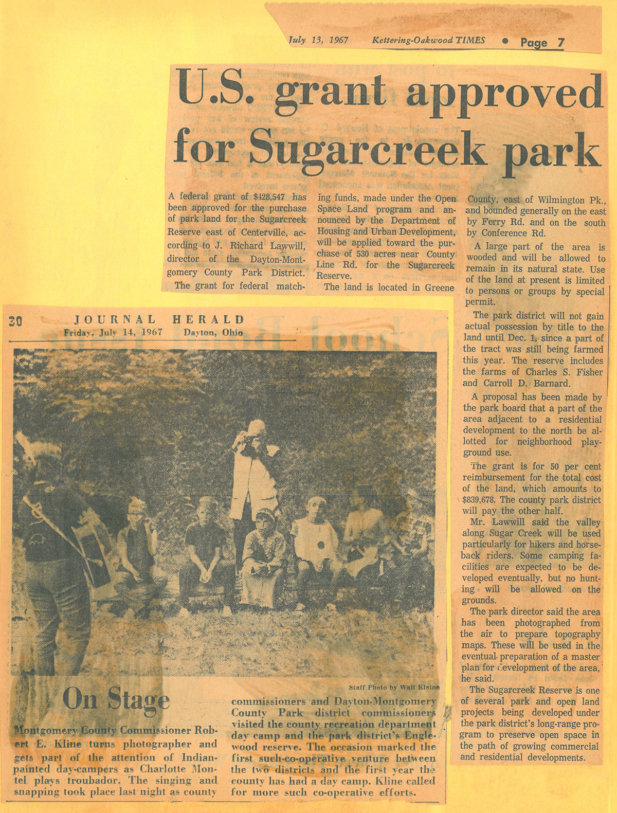
News articles from 1967
The majority of Sugarcreek is made up of two major land purchases, made in December of 1966. Much of the park was once farmland. However, it also included a stream valley and flood plain, mid-slopes and upland plain on both sides of the Sugarcreek. Parts of land had interesting forest cover and abundant wildlife.
The district began making improvements to the land including hiking and horseback riding trails, picnic areas, shelter houses, and camping areas. In July 1968, the hiking and equestrian trails were opened to the public. By 1969, the Sugarcreek Riding Academy was opened to support the growing interest in horses. In 1980′s, an archery range was added in conjunction with a group of non-profit volunteers called the Sugarcreek Archers Inc., who maintained the facility and hosted special events.
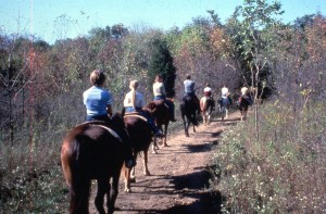
Horse riding trails
Although the archery and riding centers are no more, the park’s now 618 acres of scenic natural beauty continue to offer visitors miles of year-round trails for hiking or trail running as well as bridle trails for the equestrians. Its trio of 500-year old white oaks, fossils, varied topography, tall grass prairie, meadows, and scenic Sugar Creek offer a respite from daily life from its thousands of annual visitors.
Before it was a MetroPark
There is no documented history of Native American activity in Bellbrook, except that the Wyandots camped outside the village in route to a reservation in Kansas in 1843. However, the large rivers around the area served as waterways for travel, so there’s no doubt the Shawnees hunted and fished in and throughout the area.
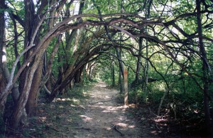
Osage Orange Tunnel
Two companies in Bellbrook advertised the making of “living fence” in the late 1800’s. It was described as “more permanent and more secure than any other fence, and highly ornamental”. They made a business of preparing the ground, setting out the plants, cultivating and trimming them until the perfect hedge was formed. One ad quoted a price of 60 cents a rod (1rod=16.5 feet) for planting, and offered two trimmings a year for $3.50 for 100 yards. This is how the Osage tunnel was originally formed at Sugarcreek MetroPark!
Sunrise
With community support and the additional funding provided by the 1994 levy, on January 1, 1995, through agreements with the City of Dayton and Miami Conservancy District, the Park District (MetroParks) added Sunrise Park, as well as Island Park, Van Cleve Park, Deeds Point, Wesleyan Nature Center, Wegerzyn Horticultural Center and river corridor areas to its facilities to provide daily management, programming and security.
Sunrise MetroPark in Autumn
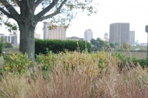
After taking on the park, MetroParks staff went to work stabilizing the park, located where Wolf Creek meets the Great Miami River between Third and First streets. They landscaped with native plants like little bluestem, purple cornflower and oxeye sunflower to attract the birds, butterflies and other urban wildlife.
In 2003, the Wolf Creek bike trail was added through the park. This one-mile stretch links the recreation trail along the Great Miami River to the bikeway that runs along James H. McGee Boulevard. The same year, MetroParks also partnered with a Sinclair Foundation to create a small wildlife observation area in the park, adding Interpretive signs to aid visitors in viewing urban plant and animal life.
Veteran’s Memorial Bridge in 2008
The aging Veteran’s Memorial Bridge over the Wolf Creek was replaced in 2010 as part of the city of Dayton’s citywide bridge replacement project. The span, designed by RW Armstrong and built by the Eagle Bridge Co., features an ornamental, neoclassic cable-stayed design with a V-shaped central tower and cables illuminated by LED technology. The new bridge replaces the classic concrete that was demolished in 2008 after 82 years of use. Architectural and historical elements of the old bridge have been saved and moved to the city of Dayton’s Friendship Park, which is adjacent to the south approach of the new bridge.
Today, Sunrise MetroPark is an excellent place to watch a surprising parade of wildlife including waterfowl, night herons, gulls, and sometimes bald eagles and ospreys, as well as watch the sunrise over downtown Dayton.
Before it was a MetroPark
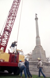
Soldiers Monument moving in 1990.
Private Fair Soldiers Monument, which now sit on an island on Main Street near Monument Avenue in downtown Dayton was originally set at Monument and Main in 1884, but was moved to Sunrise Park on the west bank of the Miami River from 1948 to 1991. This statue was modeled for Civil War veteran George Washington Fair, a bricklayer born in Dayton in 1834.
The monument was likely moved to the park for its proximity to the Veterans Memorial Bridge.
Taylorsville
Taylorsville Reserve was opened to the public on April 1, 1967. The land, part of the Great Miami River flood control system created in 1922 by the Miami Conservancy District, was leased in 1966 by Paul Lacouture, who was on the park district’s task force for buying land. He negotiated a lease contract with MCD to lease not only the Taylorsville land, but also the reserves surrounding the dams at Germantown, Taylorsville and Huffman for nature reserves that would be open to the public year round. MCD had been working with the park district since it was formed to plan recreational use of their lands, once needed for the dam construction process. In a 1964 study, it was suggested that Taylorsville would be an ideal location for picnics, primitive camping, and hiking while maintaining flood control.
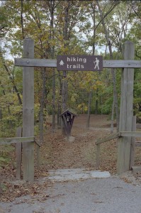
A hiking trail at Taylorsville
The upper Great Miami River valley at Taylorsville included a diverse area of floodplain and upland forest. It’s rugged eastern portion included an exposed limestone escarpment caused by an ever-flowing spring, and scenic wooded ravines sloping down to the river. The park district began making improvements to the land including additional hiking trails, picnic areas, fishing and camping areas as well as a higher level of maintenance, better surveillance and access to drinking water.
The district worked with the Ohio Buckeye Trail Association to establish a local segment of the Buckeye Trail in 1970′s through the western portion of the park. The rolling to rugged terrain of the park posed some erosion problems for the trails in the sloping east park. In 1979, the staff at Taylorsville developed a “Trail Saver” trough to carry excess water away after heavy rains. This system was used throughout the district for 30 years.
In the late 1980′s, a local chapter of the Civil Conservation Corps Alumni volunteered to repair and renovate the stone shelter in the eastern portion of the park. These volunteers contributed approximately 550 hours to the project and saved the park district thousands of dollars.
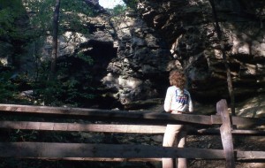
A limestone outcrop at Taylorsville
The enormous limestone outcrop in east park broke off in a rockslide in March 1984. 375 tons of 425 million-year-old limestone filled in a ravine and engulfed a 30 foot bridge. The slow, methodical combination of erosive powers (water, root penetration, freezing and thawing, and road vibrations) with a top heavy overhang caused this catastrophic rockslide of a seemingly stable valley wall. Remnants of the event can still be seen on the hiking trails.
The Great Miami bikeway construction began in a series of acquisitions and phases after the 1994 levy passage. The district planned to connect Taylorsville to Island MetroPark to the south where it connected with long-existing Horace M. Huffman Jr. River Corridor Bikeway. They also wanted to connect Taylorsville to the north to the county line, linking Tipp City, Troy and Piqua, all along the Great Miami River. In 2011, that finally became a reality when a new 2.5-mile section of the bikeway opened connecting Montgomery and Miami County. Two additional short links of the bikeway in Miami County will make it possible to go from Tipp City to Piqua by the end of 2013.
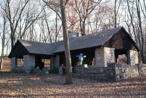
CCC shelter at Taylorsville
In 2010, “Trail Saver” troughs became a thing of the past when MetroParks embarked on a sustainable trail initiative that addressed the issues of trails suffering from erosion. The hiking trails in the east park of Taylorsville were the first to be completed in the district. The new and improved trails decreased erosion and harmful rainwater runoff that can compromise the quality of our waterways and by redesign how the trails go through the park, and created larger blocks of undisturbed habitat for wildlife.
Today the scenic forests of Taylorsville provide an interesting experience for both the hiker and bicyclist.
Before it was a MetroPark
Taylorsville Dam is an earthen embankment located across the Great Miami River in northern Montgomery County near the City of Vandalia. U.S. 40 goes across the top of the dam. Construction of the dam began in February of 1918 and was completed in November of 1921. After the Miami Conservancy District completed the construction of the Taylorsville Dam, the surrounding land was opened for recreational use. In the 1930s, Cilvilian Conservation Corps built several features in the park to enhance the visitors’ experience, including a stone shelter house that still stands today, as well as stone walls and stairways. They also planted hundreds of trees including a large oak grove and Red and Scotch Pines.
Tadmor Village
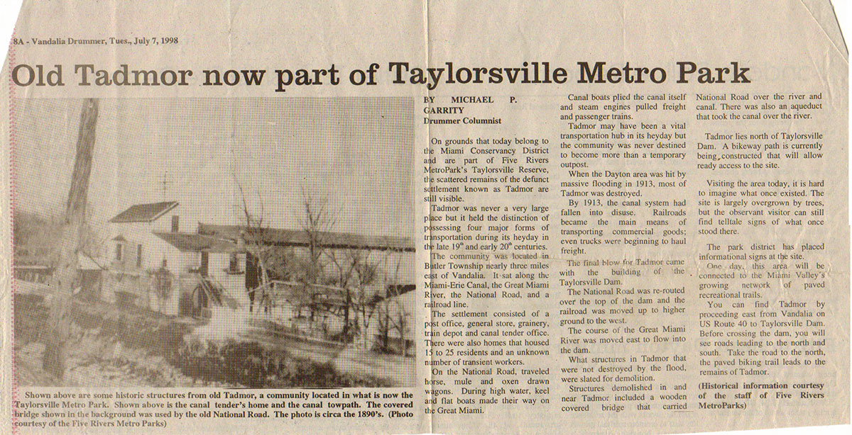
Article about Tadmor
The land where Taylorsville MetroPark now sits has a robust and storied history. It was once the site of the bustling town of Tadmor, one of the most important centers of transportation in early Ohio history.
As early as 1809, keelboats were poled up river from Dayton to take on freight from Tadmor. In 1822, the construction of a canal to connect Lake Erie to the Ohio River was commissioned. By 1837, the Miami/Erie Canal stretched, through Tadmor, connecting Cincinnati to Piqua and was finally connected to Lake Erie by 1845. Just two years later the first federally funded road (The National Road) was constructed through Tadmor. In 1851, the Dayton & Michigan Railroad established freight and passenger service to Tadmor. This faster and more dependable mode of transportation eventually led to the demise of the Miami-Erie Canal. Nevertheless, in 1852, trains, canal boats, keelboats, and wagon and coaches were heading in all directions from Tadmor. With all four means of transportation of the day within yards of each other, Tadmor was truly the Crossroads of America.
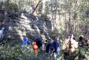
People discovering remnants of Tadmor
The great flood of 1913 put an end to Tadmor. As the Great Miami River swelled out of its banks, it drowned the stretch of train tracks surrounding the town and destroyed the aqueducts of the Miami/Erie Canal. When the water retreated, the train tracks were moved to higher ground and the canal, already in decline, was abandoned. The Miami Conservancy District took over the land and built the Taylorsville Dam in 1922. Old National Road was moved south to cross the top of the new dam. A structure or two remained in Tadmor until about 1960, when the last tenants moved out of the original grain dealer’s house and it was demolished.
Today, the Buckeye Trail follows the path of the original Dayton & Michigan Railroad through the park, and takes walkers and bikers through the ruins of Tadmor for a glimpse of important regional history.
Twin Creek
The land now known as Twin Creek MetroPark has been preserved through a series of acquisitions along the Twin Creek Corridor since 1977. The corridor is characterized by steep ravines that Twin Creek and Little Twin Creek have cut into a deep overburden of glacial sand left behind by the Ice Age. The rugged topography prevents farming and inhibits cattle grazing and lumbering. Left alone, old woods thrive, creek waters stay fresh and wildlife abounds.
In 1977 Dane Mutter, Assistant Director of the Park District at the time, learned that a 44-acre piece of land that contained part of the earthworks was for sale – this was separate from a 175 acre tract including some of the earthworks already owned by the Miami Conservancy District since 1973. Dane was a great naturalist and historian and wanted to protect the site. He arranged for the purchase of the site to protect the earthworks.
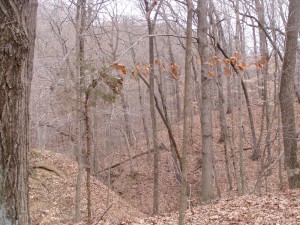
Ravines at Twin Creek
In 1986 the Park District started leasing the MCD tract. It needed some cleanup. A tenant in the small house on the property had a passion to collect old semi-trucks and some thirty or so of them were in various stages of rust decomposition at the base of the ravines. For the next several years the land was sort of a beautiful secret with no formal public access. Dave Nolin, who led MetroParks land stewardship, spent quite a bit of time exploring the “Fort Carlisle” area and came to realize that much of this beautiful area was not protected, and the site had great potential for a new park. Several additional parcels were acquired over the next few years, but to really do the job right he knew the park district needed a bolder vision.
The Park Board at the time was not very enthusiastic about taking on such a large new park, but the main problem was that they had never seen it. Director Marvin Olinsky and Deputy Director Charlie Shoemaker arranged for the Board to visit the site for their annual Board tour of the parks. Because the site was so remote and inaccessible, this was a challenge. Charlie made arrangements to rent a large helicopter and take the Board to the heart of the area where a broad meadow overlooked the winding Twin Creek. Commissioners Woodhull, Siebenthaler, and Leland stepped out into this beautiful spot and were convinced right away.
High View
After that a plan had to be put together showing the land ownership of the area and a list of desired properties. After this it came down to contacting the individual landowners to see if they were interested in selling. Each owner had a completely different story and most of them are best described as colorful. While wandering around the area, Nolin came upon an impressive hilltop overlook. It was in corn at the time, but it seemed to him that this would be a great addition to the new park if it could acquired. After some negotiation it was purchased with the help of the Miami Conservancy District from the Weidle Corporation for a fair price in the spring of 1994. This location is now known as High View.
In 1996 the Boy Scouts decided to sell their large 267 acre Camp Hook on the south edge of MetroParks holdings. The camp had a long tradition of providing formative experiences for young people, but the facilities were becoming obsolete. MetroParks purchased the camp from the Scouts in 1997. Some components of the old camp have been retained and fixed up, but most of the obsolete infrastructure has been removed. The site is open for camping and hiking, and scouts still use and enjoy their old camp. With this addition, Twin Creek MetroPark grew to 972 acres.
This big beautiful natural area was very hard to access and no one really knew about it or had yet to appreciate it. Nolan received a call from a MetroParks volunteer named Bob Johnson, who was interested in doing some trail work. Nolan threw out the idea of designing and installing a trail system for Twin Creek. Bob had already designed the color-coded trail marking system in place at Germantown MetroPark and was anxious to try this at Twin Creek. As at Germantown, Bob laid out a series of colored loops of various lengths. With the help of staff, (particularly Assistant Park Manager Bob Slusser), and volunteers the new trail system was completed in 1998.
After the installation of two small parking lots everything was ready to go, and in 1998 the new Twin Creek MetroPark was opened to the public.
In 2009, the district opened their first backpacking trail stretching from Twin Creek to Germantown MetroPark. The Twin Valley Backpacking Trail combines the existing network of trails in Germantown and Twin Creek MetroParks with a connection to create a longer, more integrated trail system totaling over 43 miles throughout 2600 acres and secluded backcountry camping that allows everyone to experience the wilds of the Twin Valley.
Twin Creek MetroPark is now an outstanding natural area containing steep, wooded ravines containing mature forest with a diverse understory plant life, extensive areas of second growth forest, floodplain forest, several large managed grasslands, a large scenic pond, and the beautiful Twin Creek. It offers visitors panoramic views and miles of hiking and equestrian trails, as well as some of the best back country experiences in the region.
Before it was a MetroPark
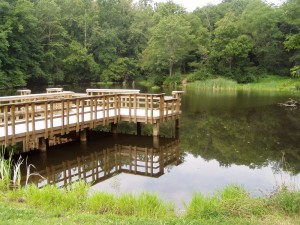
Lake George pier
In 1926, the land for Camp Hook was donated to the council. The camp opened in 1927 and operated until 1991. The land for Camp Hook was donated by the Charles R. Hook family. Charles Hook was the President of the American Rolling Mill Company (ARMCO). In early 1929 Mr. Hook donated a significant amount of stock to the Middletown Area Council with the instructions to immediately sell it and use the proceeds to put in a swimming pool at the camp. The timing on this event was advantageous considering early in the fall of 1929 was the crash of the stock market known as Black Friday and the beginning of the Great Depression. The sale of the stock yielded enough money to put in the swimming pool and purchase more land to the north, expanding the camp’s size significantly. The waterfront of the camp was later named Lake George after Charles Hook’s son, George Verity Hook. For years, Camp Hook hosted Boy Scout retreats that attracted about 100 Scouts every week.
The Chapel (now called the Natuary)
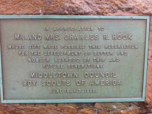
Plaque thanking the Hooks for donating the land
After the camp’s closure, the majority of the structures were torn down and the swimming pool filled in. Most of the campsites have grown over as well, but many landmarks or signs of the former use of the area remain. A large rock with embedded plaque thanking the Hooks for the donation remains, as does the amphitheatre campfire bowl, the Administration Lodge, the Maintenance Building, the Chapel (now called the Natuary) and a few other structures that are in ruins. One point of interest that remains is the Gilwell Tree. A local Scout in the 1970s took a vacation to England with his family, during which they visited Gilwell Park, the home of the Scouting movement. A sapling of one of the English Oaks was brought back from Gilwell Park and planted at Camp Hook to signify the ties between Scouting in the US and the worldwide movement. In 2010 a plaque and a split rail fence were created to honor the tree and one of the leading, and oldest, scout leaders in the Council. It was an Eagle Scout Service Project.
The Thunderbird Trail existed as a 6-mile (9.7-km) long loop around Camp Hook. It was in use for many years during the camp’s time as a part of Mound Builders Area Council and Dan Beard Council. Scouts could earn a patch upon completing the entire trail. Although the Thunderbird trail is no longer maintained, those who remember where it was may find the trail markers and Order of the Arrow (OA) fire-rings still visible.
Camp Hook remains an important place for local scout troops to camp and hold badge ceremonies. Hundreds of Boy Scouts attend the annual Camp Hook Reunion held at the park each summer.
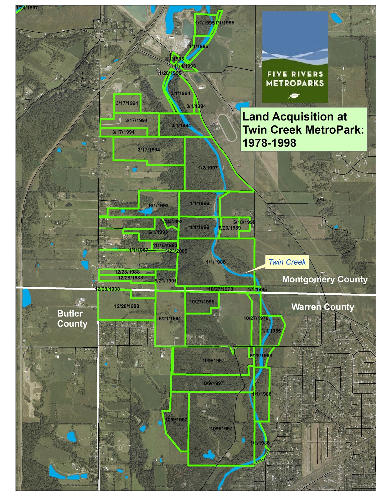
Remaining portions of Carlisle Fort
Carlisle Fort existed about 2,000 years ago. It is a Hopewell Indian hilltop fortification that lies on the west bank of the Twin Creek. It’s long, low mound winds along the edge of steep ravines and encloses about 10 acres. Carlisle Fort is thought to have been built from AD 1 to AD 300. Historians believe this type of defensive fortification was a reflective measure concerning a declining cultural race. The first survey of the site was by S.H. Binkley and C.E. Blossom in 1835. They returned to the site in 1875 for further examination. Carlisle Fort is different in respect to other earthworks located along the Scioto, Ohio, Great Miami, and the Muskingum Rivers, because of its location along a secondary waterway. The actual site is located on the peak of a hill a short distance west of the Twin Creek. On the north and south side of the hill are deep ravines; on the east of the extensive bluff is a sharp declining drop of from one hundred and twenty-five to two hundred feet. On the east of the bluff is a terrace leading to the Twin Creek.
J.P. MacLean, an early archaeologist, writes in 1885 in regards to the layout of the fort: “The terrace is separated in two parts, an upper and lower, formed in the direction of the stream. On the west the hill is connected with the level lands by a broad peninsula. The wall is not accompanied by a ditch, and is situated on the brow of the hill, except on the northern side, where it occurs a little below. The wall, for the most part, is made of surface material although limestone is found in the southwestern gate. On the west, where the enclosure is most exposed, are discovered three walls. The entire length of the wall on the direct line of the middle wall, is three thousand six hundred and seventy-six feet, and encloses an area of from twelve to fifteen acres. The length of the wall on the Twin bluff is eleven hundred and ten feet.”
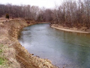
Twin Creek circa 1977
Within the enclosure two stone mounds and one stone circle was originally located, the circle being near the center of the enclosed area. The stones within this enclosure were of such great abundance that when the first white settlers first saw the enormity of this find, they hurriedly made a makeshift road. With many hundreds of wagons they removed the stone contents, which were used in building dwellings, houses, barns, wells, etc., leaving only depression marks where the stone and circle mounds once stood.
It is largely because of Fort Carlisle that Twin Creek MetroPark took shape. Most of these earthworks were on a privately owned 175-acre tract. The owner wanted the mounds, forests, and natural beauty of his land preserved. He contacted the Miami Conservancy District, and their Property Manager, Bob Riemmlin, arranged for the purchase in 1973.
Carlisle Fort was in the headlines in early 1990 concerning the installation of a 36-inch natural gas pipeline from Indiana to Lebanon, Ohio, by the American Natural Resources Pipeline Company. The Miami Valley Council of Native Americans made claims that the pipeline would interfere with the Indian burying sites. An agreement was made to install the pipeline at least 600 feet outside the Carlisle Fort border. It was added to the National Register of Historic Places concerning its safekeeping for future generations and further study.
Wegerzyn Gardens
With community support and the additional funding provided by the 1994 levy, on January 1, 1995, through agreements with the City of Dayton and Miami Conservancy District, the Park District (MetroParks) added Wegerzyn Horticultural Center along with Island Park, Van Cleve Park, Deeds Point, Wesleyan Nature Center, Sunrise Park, and river corridor areas to its facilities to provide daily management, programming and security.
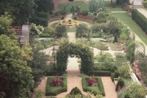
Raised view of the formal gardens
MetroParks soon assessed the entire Wegerzyn facility and the needs for additional staffing. Under the Park District, Wegerzyn Garden Center was transformed into Wegerzyn Gardens MetroPark, with a professional staff of educators, horticulturalist, horticultural/park technicians, and administrative staff, all MetroParks employees. MetroParks also assumed the responsibility of maintenance and utilities, from the City, for the Wegerzyn “portion” of the building, and put in an elevator to meet ADA requirements among other building renovations. In 1997 Mr. Wegerzyn passed away and again he gave a sizable donation to support the park.
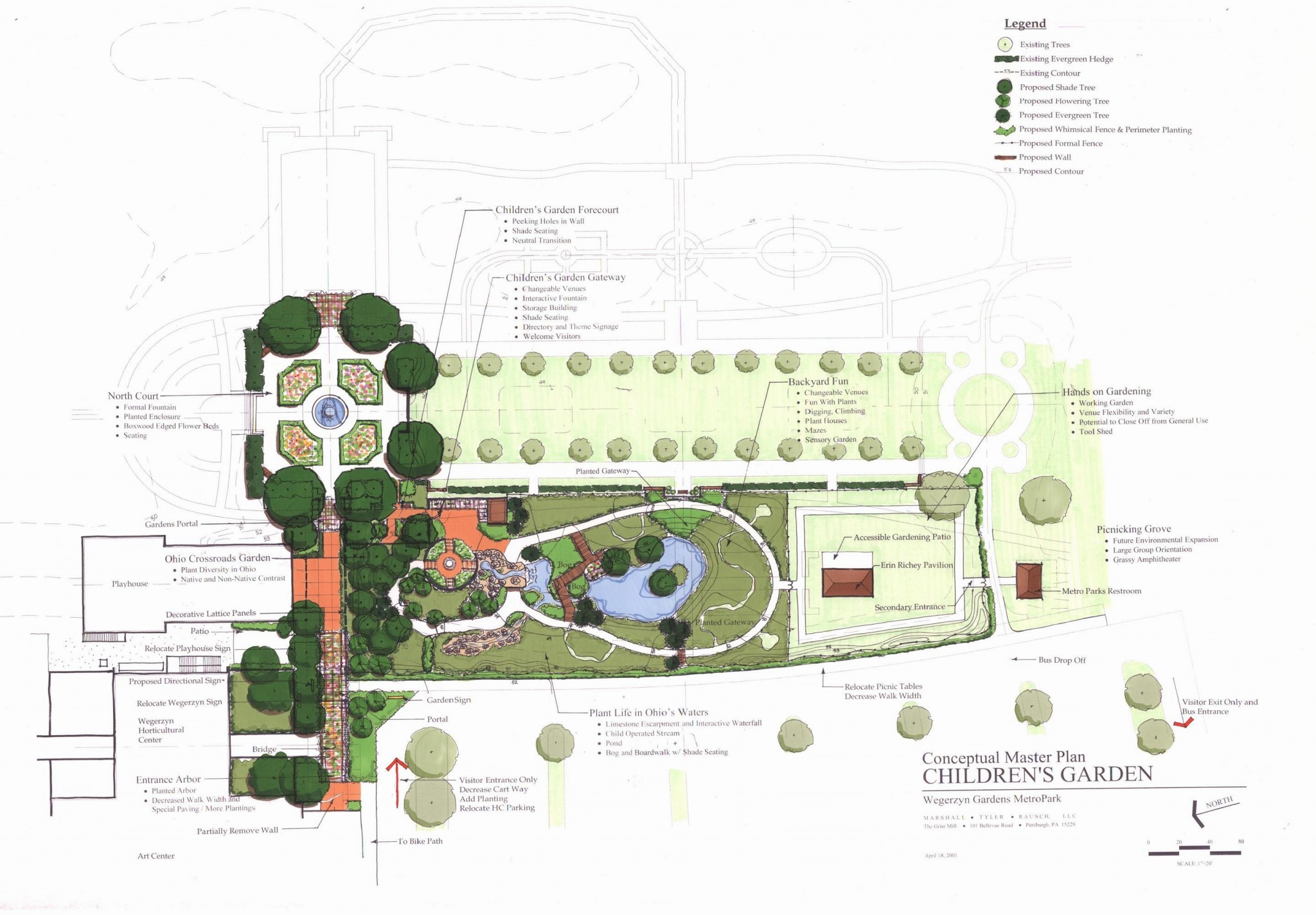
Conceptual Master Plan for the Children’s Garden circa 2001
The Foundation had been working on the design of a children’s garden and conceptual drawings were approved by the Board of Park Commissioners in 2000. The following year, after a feasibility study, the Foundation began another capital campaign to build the children’s garden. Six months into the campaign 9-11 happened and funding was a struggle during the following years. Despite this set back, the garden became a reality and opened in 2006.
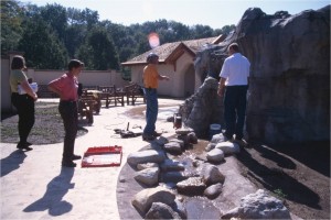
Children’s Garden under construction
In addition to the beautiful formal gardens and the interactive Children’s Discovery Garden, today’s Wegerzyn Gardens MetroPark contains an outstanding example of a swamp forest, mature woodlands along the Stillwater River, the rich aquatic life of the Stillwater River, a meadow, and two planted prairies. The Marie Aull Nature Trail is adorned by a stunning variety of trees and wildflowers, and provides many opportunities for spotting native birds and wildlife. The Wegerzyn Center remains dedicated to providing the people of the Miami Valley with learning experiences in gardening, horticulture, the environment, and urban land stewardship of the River Corridor.
Before it was a MetroPark
In the early 1960’s two organizations of garden clubs, representing their combined membership of nearly 2,000, worked together to identify a community need and formalized their vision “to create a place that would bring people and plants together.” By 1963 they shared these plans with City of Dayton Commissioners who gave approval for a horticultural complex to be built beside the Stillwater River in DeWeese Park.
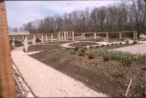
The formal gardens under construction
The first master plan included greenhouses, an activity center building, flower conservatory, and formal gardens. Construction began on the greenhouses – funded by the City and which they continue to manage today. At the same time those 2,000 garden club members began fund raising events for the garden center activity building, and during that time Mr. Benjamin Wegerzyn, philanthropist, and lover of Dayton and gardening, donated Xerox stock valued at $375,000 to the City for this structure. The garden clubs’ efforts after five years amounted to $125,000. Collectively they had $500,000 to begin construction for the center. On October 31, 1973 this garden center activity building was opened and dedicated to the people of Dayton.
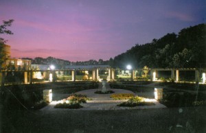
Wegerzyn in the 1990s
The next sixteen years were full of growth in programming, including the introduction of the community gardens in 1978, but funding was the heavy dark cloud which hung over the center. During these years there were two approaches made to the Montgomery County Park District to “take Wegerzyn in” but in both instances the timing was not good. Mr. George Cooper, who had retired as director of the City’s Human Resources department, was able to arrange that the City incur the expenses for the maintenance of the building and the utility costs. The trade off was to give away half of the building to construct the Riverbend Art Center to the west and the Dayton Playhouse on the east, creating the Cultural Arts Complex at DeWeese Park. These structures opened in September 1987. The reduction of the size of the auditorium resulted in the need to move one of the Center’s funding events, bingo, to an off-site location.
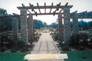
Wegerzyn in the 1990s
Jackie (Simms) McArdle, who had been a trustee for three years, was hired as director in 1986, and her objectives were huge. The board wanted formal gardens. In the next 30 months Phase I was completed – the garden green and the north and south plaza. Then in 1988 the foundation began their first capital campaign and over three years raised enough funds to continue the development of the gardens. The Arbor (former Rose) garden and reception lawn were Phase II and the period gardens, Federal, English, and Victorian were Phase III.
Bingo continued to be a huge money maker and investing in CD’s at that time allowed those funds to grow rapidly, but upon the recommendation of outside agencies the time came to separate the Wegerzyn Center from this activity. Staff was reduced down to 5 members and the future was bleak. Jackie approached the Park District for the third time, which turned out to be a good time – at last. Although the first levy failed, in November of 1994 the levy passed. Officially, on January 1, 1995 Wegerzyn became part of the park district’s family, including those last five staff employees. The Foundation was relieved of financing and overseeing the staff and could concentrate on fundraising for future development.
Wesleyan
With community support and the additional funding provided by the 1994 levy, on January 1, 1995, through agreements with the City of Dayton and Miami Conservancy District, the Park District (MetroParks) added Wesleyan Nature Center along with Island Park, Van Cleve Park, Deeds Point, Wegerzyn Horticultural Center, Sunrise Park, and river corridor areas to its facilities to provide daily management, programming and security.
The district saw the Wesleyan park, on the banks of the Wolf Creek, as a place to make wildlife much more accessible to residents in the western portion of the county and the parks surrounding urban neighborhoods – some of the region’s poorest. They envisioned building a bikeway along the creek linking Sycamore State Park, west of Trotwood, to the Great Miami River. Spin-off bikeways would connect the Wright Brothers Cycle Shop, the Paul Laurence Dunbar House and other parts of the Dayton Aviation Heritage National Historical Park. They also wanted to expand and refurbish the existing nature center, with its impressive views over the urban creek abounding with wildlife.
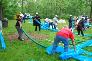
New play areas were built in May 2013
The first thing then Park Manager Jerry Jackson did was go up and down the streets, knocking on doors and introducing himself. Residents told him they’d been trying to get the city to tear down the basketball courts that were drawing rowdy teenagers from other neighborhoods. The courts were removed.
Through the PARKS 2000 initiative, the district installed playground equipment, better lighting, a picnic area and new restrooms, and performed significant cleaning, grading and seeding the grounds. In addition, overgrown vegetation was removed to open up the landscape for safety. Staff worked with local youth groups to make improvements and get them to appreciate the park. Children from the neighborhood cleaned up the grounds at Wesleyan every morning in the summer those first few years. It wasn’t all work. They also used the playground, walked the Wolf Creek nature trail and studied the wildlife and fossils in the Junior Naturalists Club. The district made a commitment to making the place a clean, safe park.
The district began to offer a regular lineup of activities and programs to the nature center to bring people back to the now clean and safe park. But Park district director Marvin Olinsky thought bigger – bigger scope, bigger community impact.
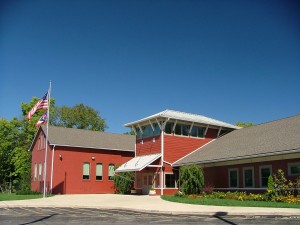
Adventure Central
Olinksy had an idea to bring the 4H experiences that he had as a kid growing up in an urban neighborhood to the children of Wesleyan neighborhood near the park. He shared his idea with his wife, Chris, who’s an OSU Extension agent. He talked to OSU leaders such as Bob Moser, agricultural dean and vice president. He and others began building alliances with city and county officials, school administrators and neighborhood associations. There were 20 acres of woodland and green space to use for environmental education at Wesleyan easily accessible by car, bus, bike and foot – a perfect location for a new “nature center” utilizing these community partnerships. Adventure Central was born out of these partnerships, principally between Five Rivers MetroParks and Ohio State University’s 4-H Club program. But it also relied upon a network of friends and neighbors and help from organizations such as AmeriCorps.
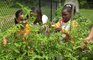
Children gardening at Wesleyan
MetroParks staff and 4-H leaders wanted to build a facility to meet the community’s needs, so they designed it by talking to kids and to neighbors. The result, opened in 2000, has an inviting interior, which is open, light and safe. It includes plenty of spaces for one-on-one homework help and group gatherings. There’s a kitchen, lockers for the kids, a place for a store to sell things kids make and more. Adventure Central began to offer a safe and stimulating environment for urban schoolchildren on a year-round basis.
Today, Adventure Central at Wesleyan MetroPark is an education center for youth ages 5-18. Adventure Central serves youth in West Dayton as a hub for out-of-school time programming to include after school programs, activity nights, day and overnight camps, as well as parent and family programs. Through this innovative partnership with Five Rivers MetroParks, Ohio State University Extension, and 4-H, participants spend time connecting with nature in a positive youth development context for the intended outcome of creating caring, capable, and contributing citizens of tomorrow.
The Wolf Creek Bikeway connection to the park was finalized in 2004 when the bridge over the creek was constructed, finally connecting both sides of the park. The bridge did not only benefit those on bike, but it provided access to the main part of the park for Adventure Central children. About the same time, MetroParks added about seven acres and two new woodland trails to the park. The Wolf Creek Bikeway continues to be pieced together, realizing the original vision to link Sycamore State Park, west of Trotwood, to the Great Miami River. Although the bikeway remains unconnected west of Little Richmond Rd, a western segment now extends well beyond Sycamore State Park to the border of Preble County. The eastern segment connects from the Great Miami through Wesleyan to Little Richmond.
Wesleyan MetroPark remains a popular place for picnics and strolls through the winding trails overlooking the Wolf Creek. It’s hard to believe this scenic, natural area is located within Dayton city limits. Beautiful woodlands, the river and wildlife bring urban residents close to nature. Plans are underway for significant enhancements to the playground in the summer of 2013.
Before it was a MetroPark
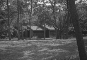
Wesleyan Nature Center circa 1996
Long before the ravages of industrial run-off, urban sprawl, crime and community neglect took its toll, a 20-acre cleft set deep in the heart of the city was a greenspace for generations of youngsters who played games and fought make-believe battles beneath its lush canopies. This was Wesleyan Nature Center.
Ensuing decades saw the area decline, and the park became a nuisance for the community. The City of Dayton was strapped for resources and was unable to keep the park in a condition welcoming to children. Violence and illicit activities became commonplace. Fights kept neighbors up at night. Broken glass littered the park.
The former playground area circa 1996
In 1992, land became available on the south bank of the Wolf Creek with frontage to the busy James H McGee Blvd. The City of Dayton purchased the land with a grant awarded through the federal Land and Water Conservation Fund. It was intended to provide new space for a wetland as part of the things to look at from the nature center and an entrance to the nature center from James H. McGee Boulevard to improve the park’s visibility.
By 1995, the city’s plans for the park had been impacted by budget constraints and the park was turned over to Five Rivers MetroParks.