Conservation Leadership
What We Protect
Protecting open space and natural areas is a priority for Five Rivers MetroParks, which protects nearly 16,000 acres of land — 90 percent of it in its natural state.

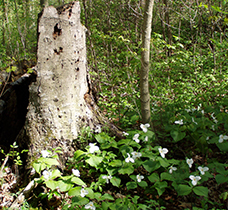
Natural areas in MetroParks are managed so that habitat for plants and wildlife takes precedence. Doing so preserves clean water and air, supports plant and wildlife biodiversity, and provides beautiful places where people can connect with nature.
Five Rivers MetroParks is guided by these land protection goals:
- Protect significant natural areas, particularly adjacent to existing MetroParks and river corridors, in the Miami Valley
- Protect and connect significant tracts of forest
- Link forests and park lands along river corridors
- Establish buffer areas where needed to maintain open space and protect watersheds
In addition, MetroParks’ conservation department is guided by these principles:
- Actively manage designated habitats to ensure future plant and animal diversity
- Use the best science available to inform management decisions
- Determine the best use of available resources for maximum impact
Five Rivers MetroParks protects and manages five primary habitat types: forest, edge/thicket (young forest), grassland, wetland and aquatic areas. Staff develops habitat management plans for each park and conservation area to guide land protection and restoration. The conservation and park services departments then work together closely to complete the annual habitat action plans for each park to ensure goals are met.
In addition to its parks, Five Rivers MetroParks protects conservation areas, which are significant tracts of land primarily in a natural state with minimal infrastructure. Three of these have enhanced public access — Dull Woods, Medlar and Woodman Fen — while other conservation areas (listed below) currently have very limited access due to lack of trails and parking.
Conservation Areas
Great Miami Mitigation Bank Conservation Area
 Location: Trotwood, adjacent to Sycamore State Park
Acres: 540
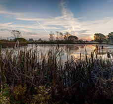
The story: Five Rivers MetroParks is converting this area to grassland, forest and wetlands. It includes 360 acres that are a mitigation bank, previously farmland and once slated for a landfill. The remaining 180 acres are the former Larch Tree golf course, which Five Rivers MetroParks acquired in 2015. The land is still developing different habitats but already includes wetlands and prairie, and thousands of tree seedlings have been planted. The mitigation bank also serves as a regional economic development tool: If an existing wetland is damaged, qualified developers can purchase federally required credits from the Great Miami Mitigation Bank. The funds are used to restore wetlands at the mitigation bank and support other projects in MetroParks. Because wetland banks are on larger tracts of land, they are more effective at replacing the wetlands that are lost. The Great Miami Mitigation Bank is the first mitigation bank in Ohio owned, designed and managed by a conservation agency.
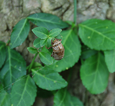
Why it’s important: Acting as the kidneys of our ecosystem, wetlands improve water quality and help with flood abatement while providing plant and wildlife habitat. This conservation area, with its vicinity to Sycamore State Park, represents one of the largest tracts of open land in Montgomery County, creating critical habitat for such native wildlife as rare bird species. Combined with the adjacent Larch Tree golf course, the area makes up more than 500 acres of contiguous wildlife habitat just west of Dayton. Since the mitigation bank was established in 2008, volunteers have spotted more than 89 species of birds at the wetland, including Ohio endangered species, such as American bittern and sandhill cranes, and state species of concern, such as sora rails, bobolinks, grasshopper sparrows and sedge wrens. This site also provides a unique opportunity to study wetlands and greenhouse gases in a partnership with Kansas State University.
Huffman Prairie State Natural Landmark
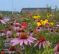 Location: On Wright-Patterson Air Force Base (WPAFB) and adjacent to the Huffman Prairie Flying Field, where the Wright brothers once tested their planes and now part of the Dayton Aviation Heritage National Park.
Acres: 112
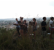
The story: MetroParks has partnered with WPAFB, The Nature Conservancy, U.S. Fish and Wildlife Service and National Park Service to restore and manage Huffman Prairie. Since 1988, these partners have harvested seed, restored degraded sections of the prairie, conducted controlled burns and coordinated research projects.
Why it’s important: Today, the Huffman Prairie State Natural Landmark is one of the largest prairie remnants in Ohio. Many rare plants, birds and insects make the prairie their home. Indeed, Huffman Prairie hosts one the best displays of Ohio prairie grasses and flowers, as well as impressive populations of rare grassland birds, such as bobolinks, dickcissels and sedge wrens. Other unusual species documented on the prairie include the smooth green snake, thirteen-lined ground squirrel, and more than 200 species of butterflies and moths — including one found only in this prairie.
Needmore Conservation Area
 Location: located in three separate tracks along the Great Miami River north of Dayton, near Needmore Road and Old Troy Park
Acres: 160
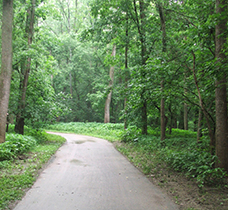
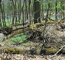
The story: This area is largely characterized by floodplain forest. The Great Miami River Trail passes through the north section. Five Rivers MetroParks is controlling honeysuckle and other invasive species, reintroducing native shrubs and trees, and establishing a tallgrass prairie to ensure a diverse future forest.
Why it’s important: This tract of land contains mature woodlands at a key location — along the corridor of the Great Miami River.
Pigeye Conservation Area
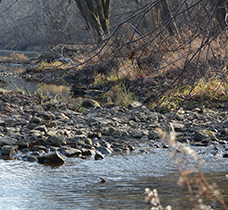 Location: adjacent to the Stillwater River in Montgomery and Miami counties, near Old Springfield Road and State Rt. 48
Acres: 111.2
The story: MetroParks is controlling honeysuckle and other invasive species and maintaining a meadow grassland.
Why it’s important: This diverse conservation area features mature upland and bottomland forest, abundant wildflowers, thickets, a spring-fed wetland, and Pigeye Creek, a spring-fed stream. Historical artifacts include the site of a former covered bridge, mill race and a Hopewell enclosure mound.
River Ridge Conservation Area
 Location: along the Stillwater River north of Dayton, near Meeker Road and Westfall Drive
Acres: 8.5 acres
The story: MetroParks is controlling honeysuckle and other invasive species to ensure a diverse future forest.
Why it’s important: River Ridge includes rich upland and bottomland forest at a key location along a river corridor. The area also provides a nature trail for the neighborhood.
Sand Ridge Conservation Area
 Location: Moraine
Acres: 5
The story: Sand Ridge is a prairie remnant on a steep west- and southwest-facing slope of a glacial kame, a hill composed of sand and gravel. Nearly all the land around the remnant has been heavily modified by gravel mining. Five Rivers MetroParks’ priority is maintaining the intact prairie remnants and recovering the remaining land.
Why it’s important: This sand slope prairie, more characteristic of the western part of the Great Plains, is unique in this part of Ohio. Rarities found at the site include two species of grass found nowhere else in Montgomery County. The site also contains green milkweed, an important plant for pollinators.
Shiloh Woods Conservation Area
 Location: along the Stillwater River between Wegerzyn Gardens MetroPark and Englewood MetroPark
Acres: 385
The story: Five Rivers MetroParks is controlling honeysuckle and other invasive species, reintroducing native shrubs and trees, and protecting a tallgrass prairie planting to ensure a diverse future forest. The agency also is managing such habitats as meadows, pond-edge vegetation, wetlands and ponds.
Why it’s important: This tract of land contains two outstanding tracts of mature upland forest, successional areas, a pond and a small cedar glade/prairie at a key location — along a river corridor that connects two already protected areas. Protecting this area helps maintain the Stillwater River’s outstanding aquatic diversity.
Shoup Mill Conservation Area
 Location: located in two separate tracks along the Stillwater River north of Dayton, near Frederick Pike and Shoup Mill Road
Acres: 67
The story: MetroParks is controlling honeysuckle and other invasive species and reintroducing native shrubs and trees to ensure a diverse future forest.
Why it’s important: This conservation area contains mature riparian forest along the river corridor of the scenic, biologically rich Stillwater River.
Upper Twin Conservation Area
 Location: along the Twin Creek northwest of Germantown MetroPark
Acres: 390
The story: Five Rivers MetroParks is controlling honeysuckle and other invasive species, reintroducing native shrubs and trees, and managing such habitats as meadows, wetlands and ponds.
Why it’s important: This undeveloped land contains an outstanding tract of old growth forest, mature floodplain forest, young woodland and former crop fields. It is exceptionally wild and quiet, and its vicinity to Germantown and Twin Creek MetroParks creates a large tract of wilderness that provides critical habitat for wildlife. It has outstanding views of Twin Creek and the potential for a future connection to the Twin Valley Trail.